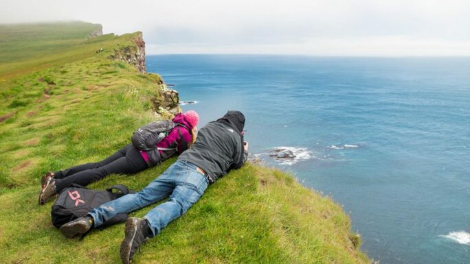
Icelandic 500 meter walk champions
All distances are one-way
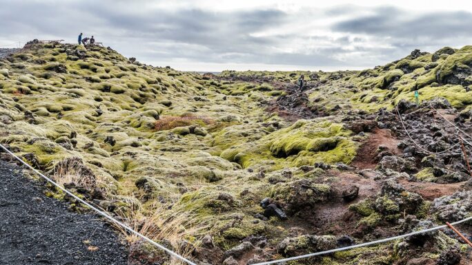
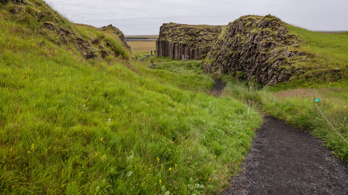
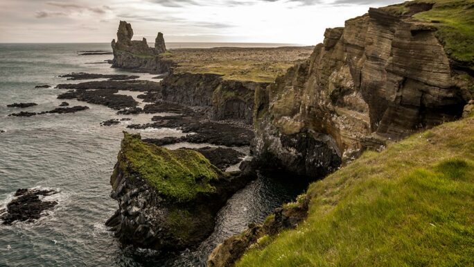
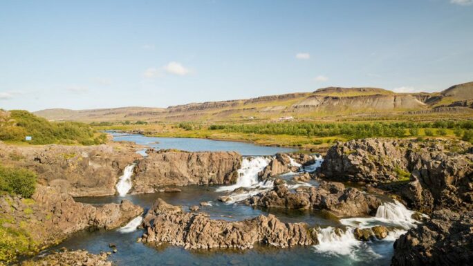
Eldhraun Lava Field
50 meters, terrain
A vast lava field (565 km²) covered in moss, formed by the Laki volcanic eruption in 1783–1784, southwest of Kirkjubæjarklaustur.
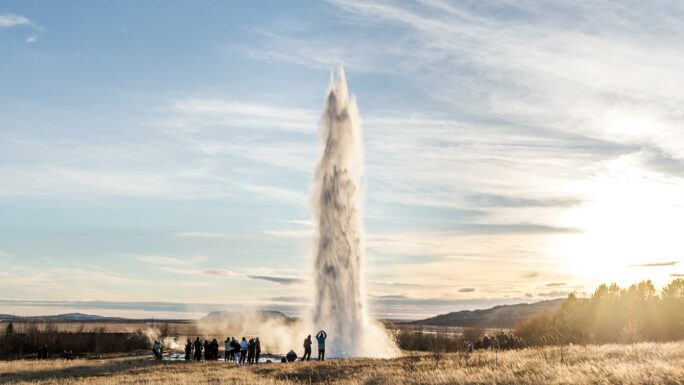
Strokkur!!!
300 meters, artificial terrain
The most famous active geyser in Iceland, erupting every 5–8 minutes and shooting water 20–25 meters into the air – part of the Golden Circle.
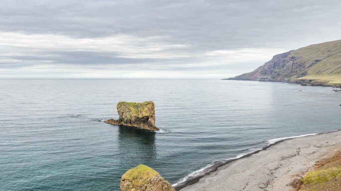
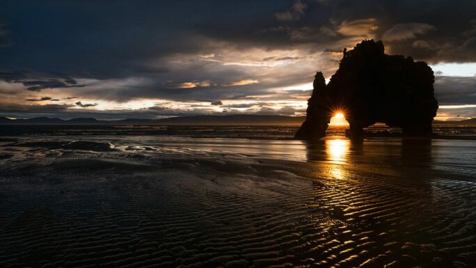
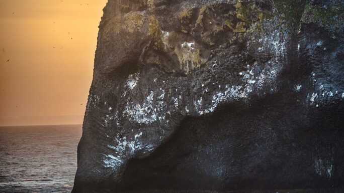
Ljósastapi
100 meters, terrain
A rock formation resembling an elephant, visible from Skjólfjörur beach, 20 km east of Vopnafjörður.
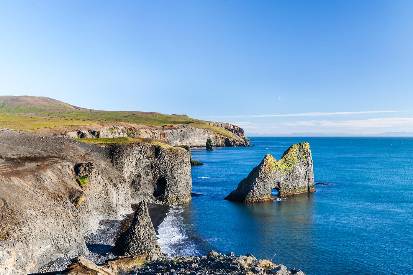
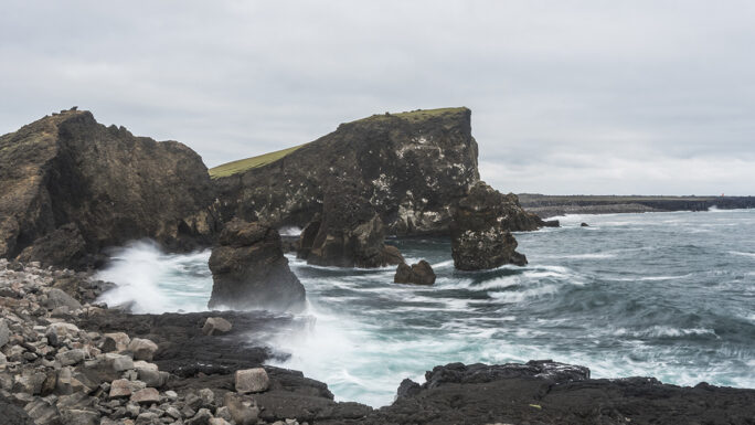
Hestfall
200 meters, terrain
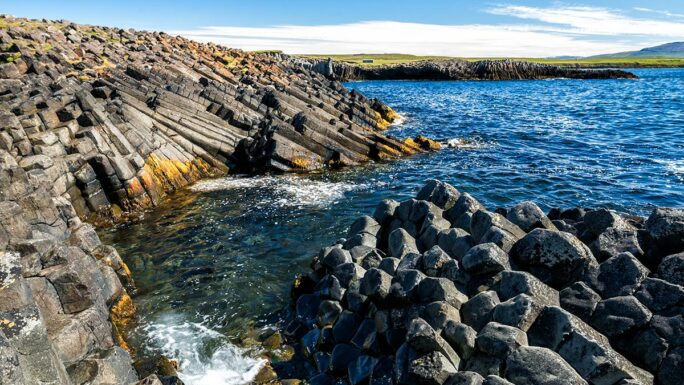
Interesting rock formations on the western coast of the Melrakkaslétta peninsula, accessible from cliffs or the beach.
Hveravellir
200 meters, developed terrain
A geothermal oasis in the highlands with hot springs, fumaroles, and mud pools along the historic Kjölur route.
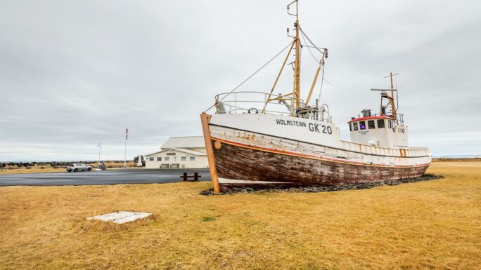
Fishing Vessel Holmsteinn
10 meters
A historic fishing boat permanently anchored in the harbor as a reminder of Iceland’s fishing heritage.
Hringsbjarg Cliffs
10 meters, developed terrain
Cliffs on the Tjörnes peninsula.
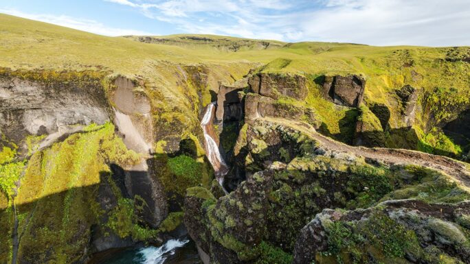
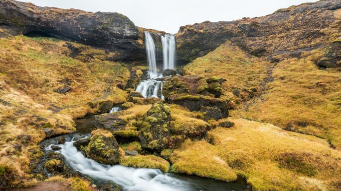
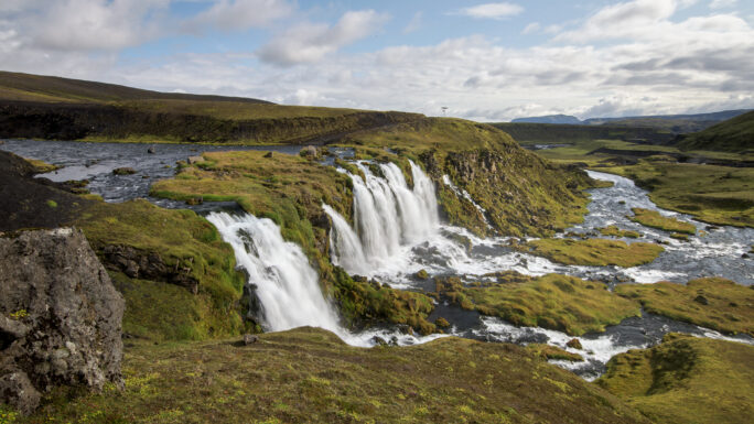
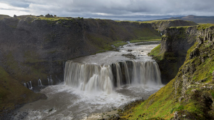
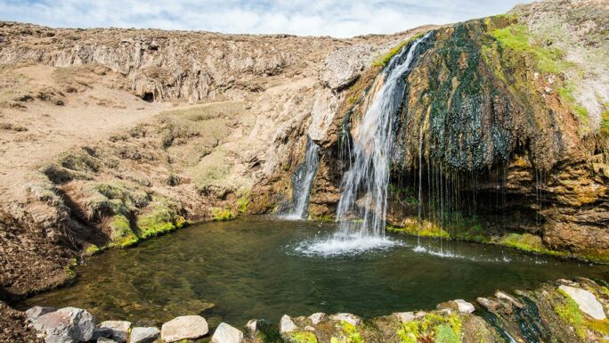
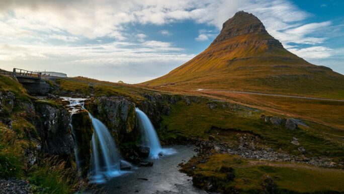
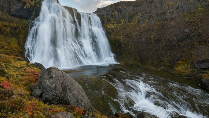
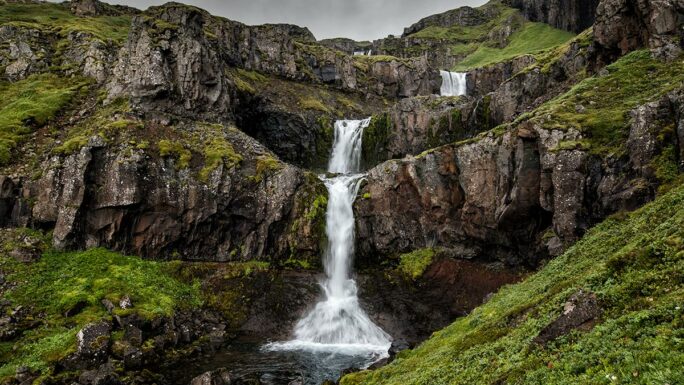
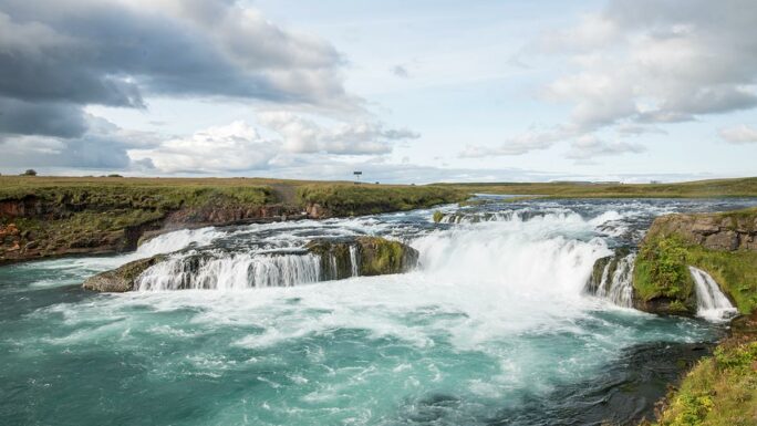
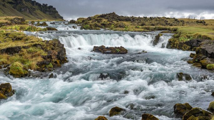
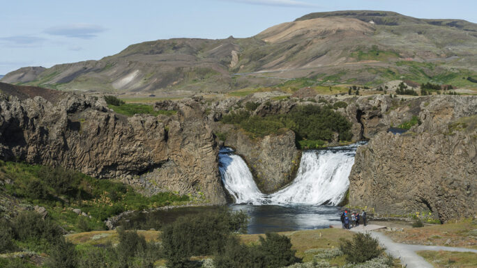
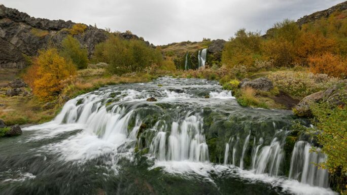
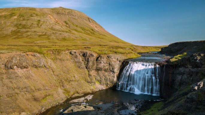
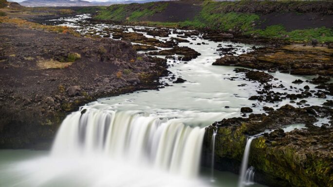
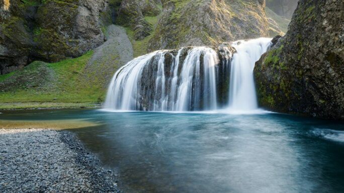
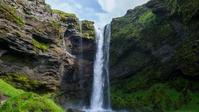
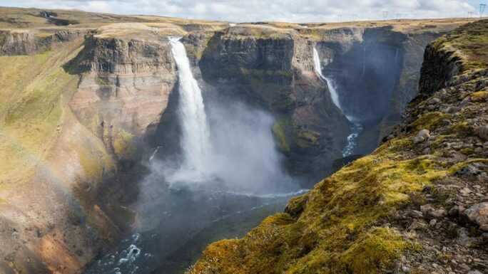
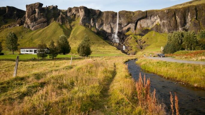
Mogáfoss (Fjaðrárgljúfur)!
500 meters, developed terrain
A waterfall hidden in the scenic Fjaðrárgljúfur canyon, one of the lesser-visited gems of southern Iceland.
Geysir (Father of All Geysers)!
300 meters, artificial terrain
A historic geyser that gave all geysers their name – today mostly dormant, located in the Haukadalur geothermal area.
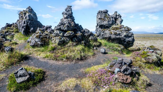
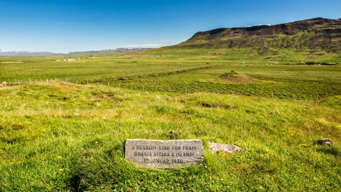
Laufskalavarda
30 meters, developed terrain
Pyramids of lava stones built by travelers over centuries.
Geirsstaðakirkja!!!
50 meters, developed terrain
A historic church with Viking heritage linked to King Óláfr Geirstaðaálf, one of the unique sacred sites in southern Iceland.
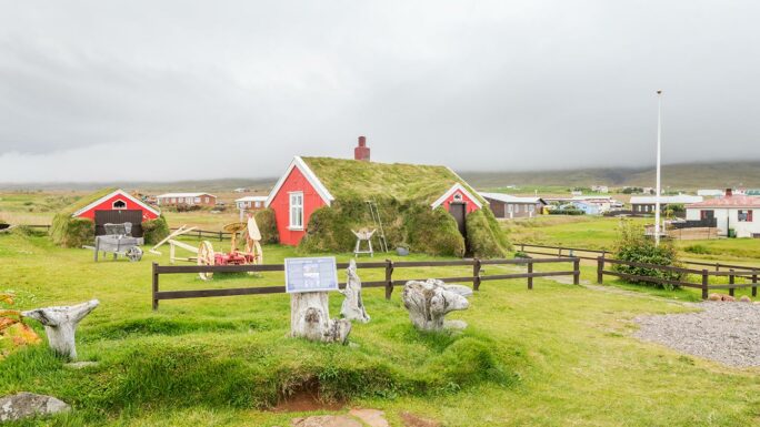
Lindarbakki
30 meters, developed terrain
A charming red turf-covered house in Borgarfjörður eystri, one of the most photogenic buildings in Iceland.
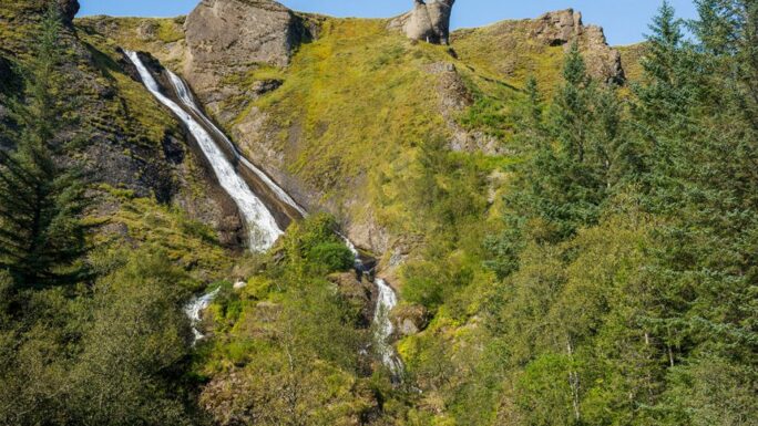
Selvallafoss
100 meters, terrain
A quiet waterfall in eastern Iceland hidden in green landscapes far from tourist routes.
Írafoss
50 meters, terrain
A compact waterfall on the Hvítá river in southwest Iceland, easily accessible from the main road.
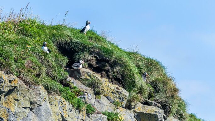
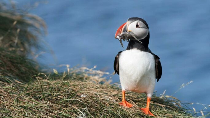
Dyrhólaey puffins!!!
200 meters, developed terrain
A rock promontory in southern Iceland famous for puffin colonies.
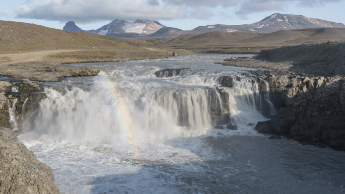
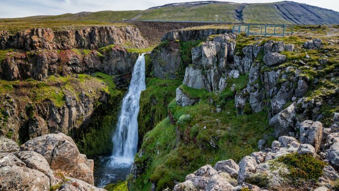
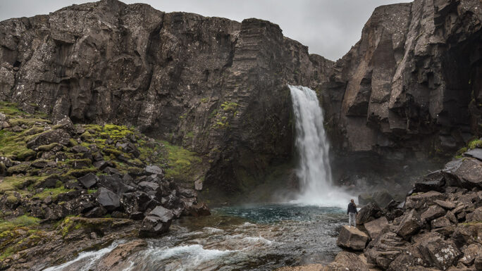
Rjúkandi!
100 meters, developed terrain
A picturesque waterfall in eastern Iceland right next to Route 1, easily accessible and especially photogenic in autumn.
Rauðarfoss??
300 meters, terrain
A waterfall near Kirkjubæjarklaustur with reddish rock tones, rarely visited and naturally untouched.
Árbæjarfoss
100 meters from small parking area, terrain
A waterfall on the outskirts of Reykjavík in a natural area, popular for easy hikes.
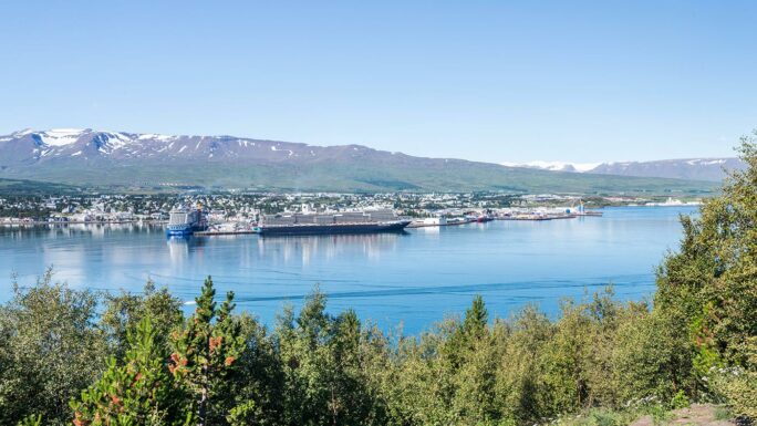
View over Akureyri
10 meters, artificial surface
A viewpoint above Akureyri with panoramic views over Eyjafjörður fjord and Iceland’s second-largest city.
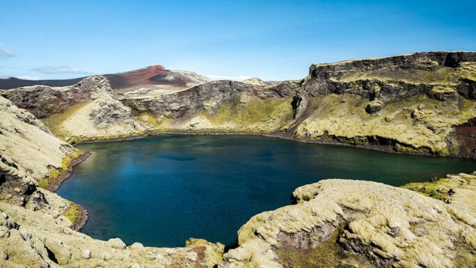
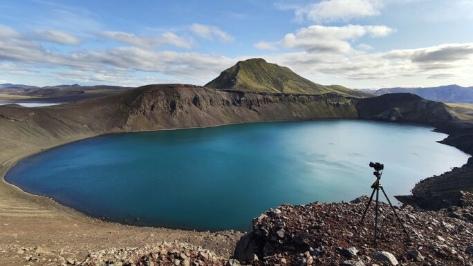
Tjarnargígur
250 meters, complex terrain
An impressive crater lake near Mývatn with steep walls, accessible via a challenging trail.
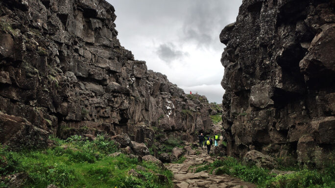
Þingvellir
developed terrain
A national park and the site of Iceland’s first parliament (930 AD), located on a rift between the North American and Eurasian tectonic plates.
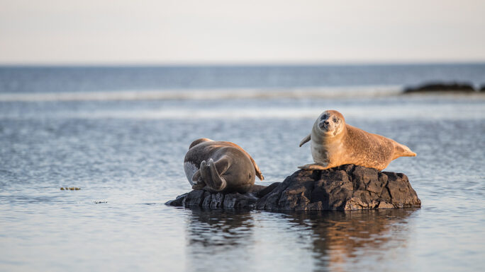
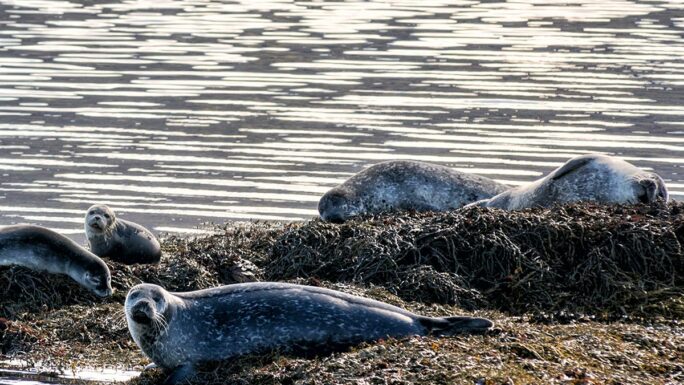
Ytri Tunga
200 meters, terrain
A beach on the Snæfellsnes peninsula where seals regularly rest near the shore access road.
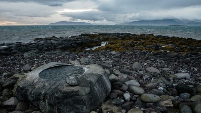
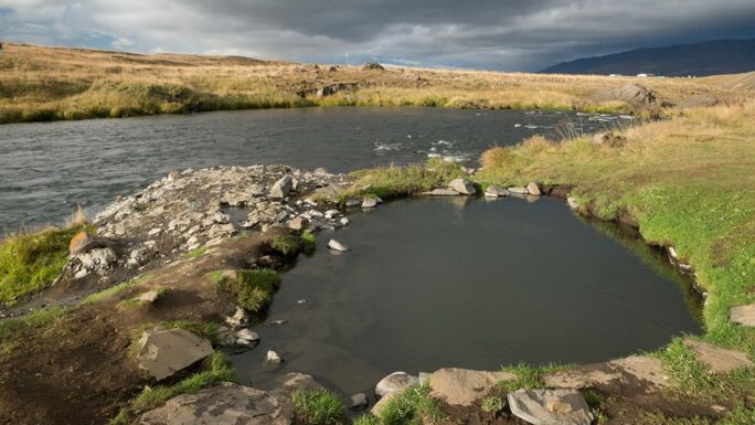
Gýgagjá
30 meters, terrain
A clear geothermal pool in the Haukadalur area with a striking blue-green water color.
Valahnjúkur
200 meters, terrain
A low but prominent basalt formation on the Reykjanes peninsula overlooking the coast and Reykjaneshöfn harbor.
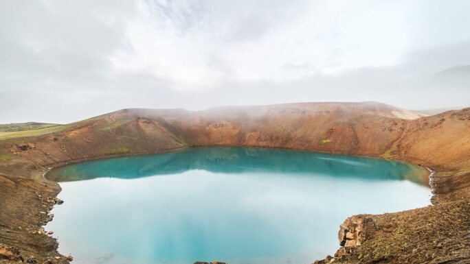
Víti (Krafla)
100 meters, developed terrain
A turquoise crater lake in the geothermal Krafla caldera near Mývatn.
Þakgil
500 meters, developed terrain
A dramatic valley with cliff walls and a campsite hidden behind black rock walls in southern Iceland – an atmospheric, otherworldly place.
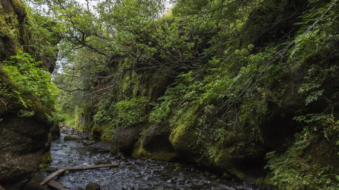
Nauthúsagil
500 meters, terrain
A narrow gorge with moss-covered walls and a hidden waterfall in southern Iceland, requiring river crossings.
Ljótipollur
30 meters, terrain
A crater lake with red-brown slopes and turquoise water in the Fjallabak area – one of Iceland’s most colorful landscapes.
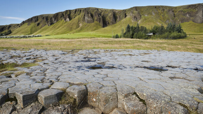
Kirkjugólf
350 meters, developed terrain
Natural basalt column pavement resembling a cathedral floor near Kirkjubæjarklaustur.
Hnausapollur
50 meters, terrain
A small crater lake in the Fjallabak region with distinctive red-brown volcanic slopes.
Gýgjarfoss
10 meters, terrain
A modest waterfall near the Hveravellir geothermal oasis, easily accessible from the campsite.
Grafarkirkja
250 meters, developed terrain
The oldest preserved turf church in Iceland (17th century) in the north near Höfðaströnd.
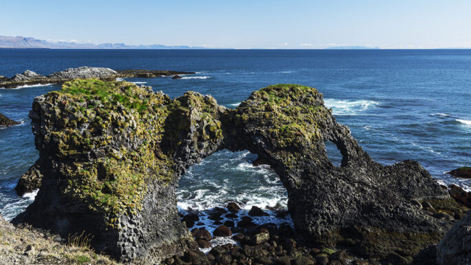
Gatklettur
350 meters, artificial terrain
A smooth basalt rock formation in western Iceland with views over fjords, popular as a picnic spot.
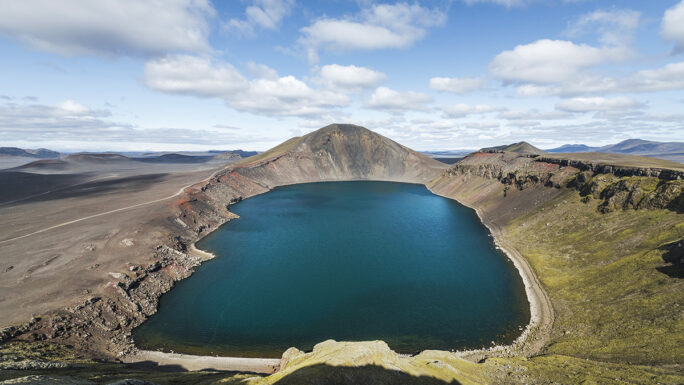
Frostastaðavatn
20 meters, terrain
A highland lake in the Fjallabak region with panoramic views of volcanic mountains and colorful landscapes.
Eystrahorn
20 meters, terrain
A dramatic basalt mountain on the Stokksnes peninsula in eastern Iceland, the counterpart to the more famous Vestrahorn.
Eggin í Gleðivík
50 meters, artificial terrain
An art installation of 34 basalt “eggs” on the coast in Neskaupstaður – a symbol of hope and fertility in Icelandic nature.
Dverghamrar
250 meters, terrain
A striking group of basalt columns and dwarf-like formations by Route 1 in southern Iceland.
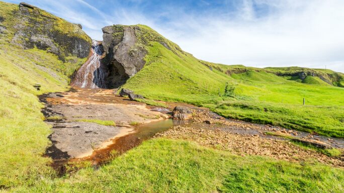
Deildartunguhver
100 meters, artificial terrain
The most powerful hot spring in Europe, producing 180 liters of boiling water per second in the Borgarnes area.
Bláfjallafoss
30 meters, terrain
A compact waterfall hidden in western Iceland, easily accessible from the road with a beautiful green setting.
Axlafoss
50 meters, terrain
A waterfall in northwest Iceland with a hiking trail through classic Icelandic landscapes.
Arnarstapi lookout
20 meters, artificial terrain
A viewpoint in the fishing village of Arnarstapi on Snæfellsnes with views of glaciers and basalt cliffs.
Laugarvallalaug!
250 meters, terrain
A wild geothermal pool in eastern Iceland, a hidden gem with no infrastructure.
Djúpavogskórin
No longer exists
A former geothermal pool with a beautiful view, now disappeared.
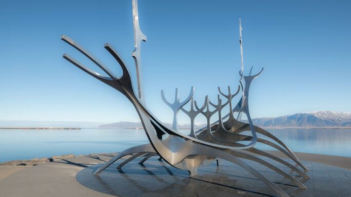
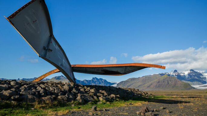
Sun Voyager (Sólfar)
200 meters, artificial terrain
An iconic steel sculpture of a Viking ship on Reykjavík’s waterfront, symbolizing the dream of exploration.
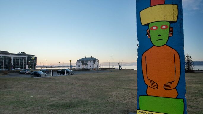
Piece of the Berlin Wall
100 meters, artificial terrain
An original section of the Berlin Wall placed in Reykjavík as a symbol of freedom.
Kirkjufell
150 meters, developed terrain
Iceland’s most photographed mountain (463 m), shaped like a peak, on the Snæfellsnes peninsula with Kirkjufellsfoss waterfall in front.
Þrístapar
150 meters, developed terrain
Three basalt columns on Snæfellsnes linked to Icelandic elf folklore and hidden people legends.
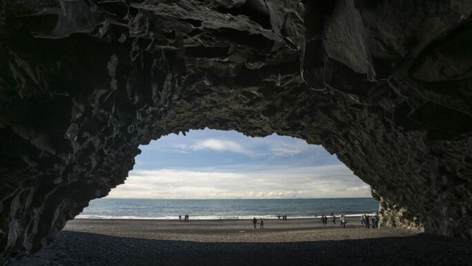
Hálsanefshellir
It is underwater…
A basalt cave on Reynisfjara beach, accessible only at low tide – dangerous and flooded at high tide.
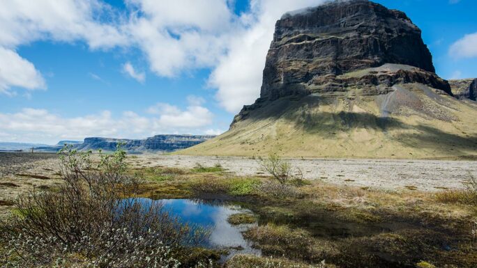
Lómagnúpur (viewpoint)
10 meters, artificial terrain
A monumental cliff rising 766 m above southern Iceland – one of the most impressive natural barriers.
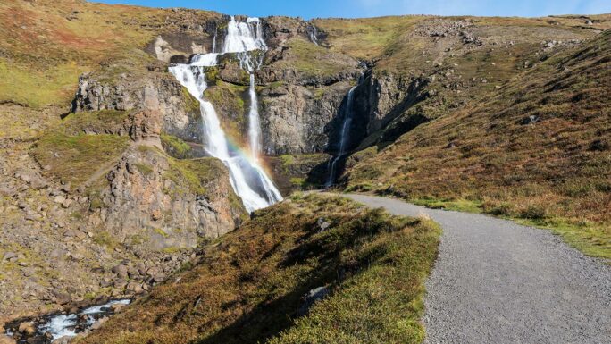
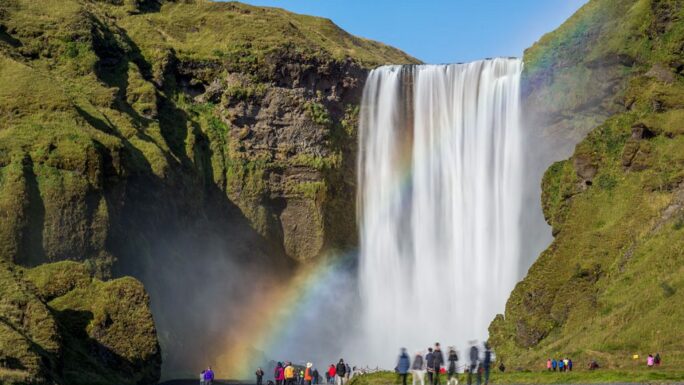
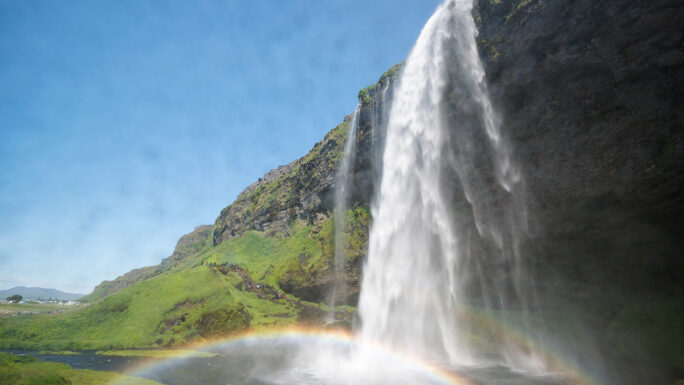
Skógafoss!!!
250 meters, developed terrain
One of Iceland’s largest waterfalls (60 m), with direct access, rainbows in sunlight, and a viewing trail above.
Hvítserkur
300 meters, developed terrain
A basalt sea stack resembling a rhinoceros or mammoth standing in the sea off Vatnsnes peninsula.
Halldórsskora
500 meters, terrain
A mountain pass in the Westfjords offering wild terrain and remote Icelandic scenery.
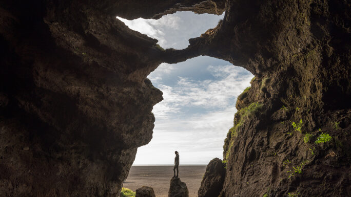
Loftsalahellir
350 meters, terrain, uphill
A lava cave in southern Iceland with natural lava formations, accessible via a steep trail.
Seljalandsfoss!!!
150 meters, mixed terrain
An iconic waterfall with a path behind its curtain of water – a unique experience of walking behind the falls.
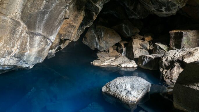
Grjótagjá!
50 meters, terrain
A mystical lava cave with a geothermal hot spring near Mývatn, made famous by Game of Thrones.
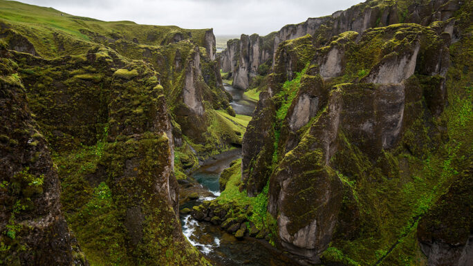
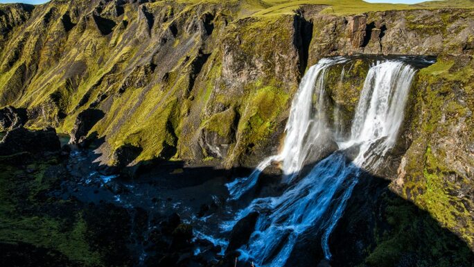
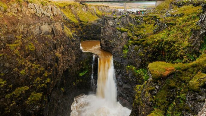
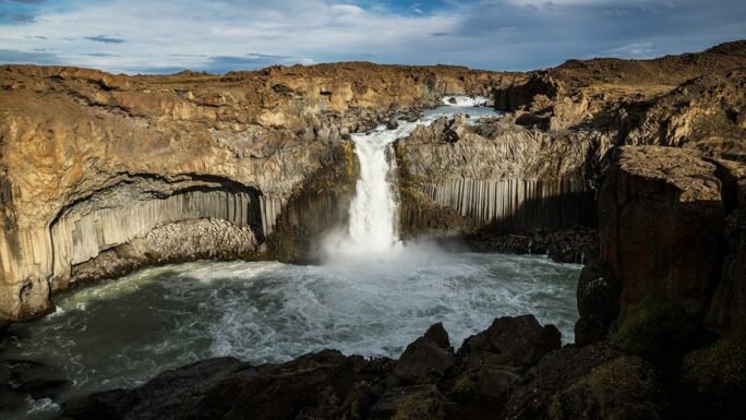
Fjaðrárgljúfur!
100 meters, terrain
One of Iceland’s most beautiful canyons (2 km long, 100 m deep) with turquoise river bends in the south.
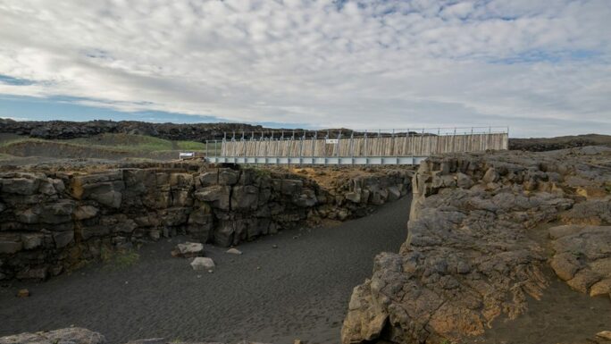
Bridge Between Continents
150 meters, developed terrain
A symbolic bridge over a rift on the Reykjanes peninsula where the North American and Eurasian plates meet.
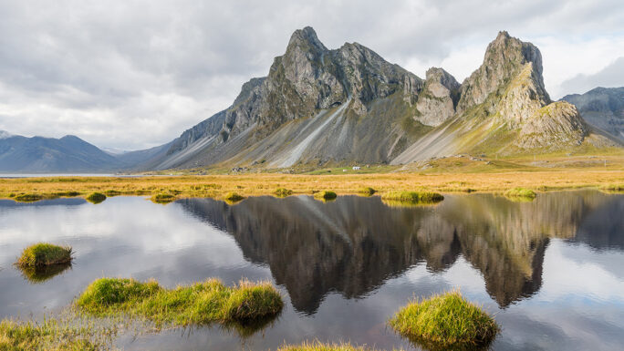
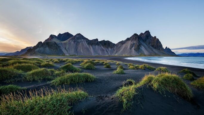
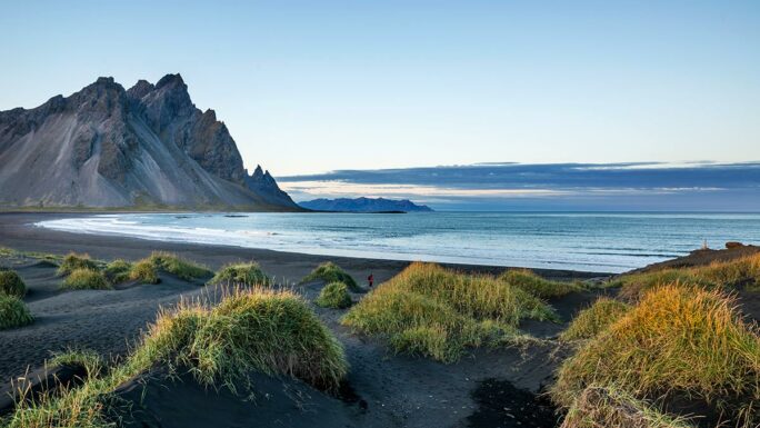
Vestrahorn
50 meters, terrain
A dramatic basalt mountain (454 m) on the Stokksnes peninsula, one of the most photographed landscapes in eastern Iceland.
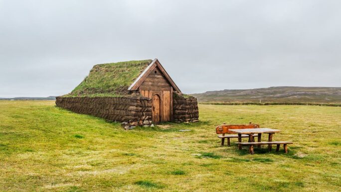
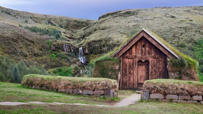
Þjóðveldisbærinn Stöng
100 meters, developed terrain
A reconstruction of a Viking-age farm from the 10th century, buried by volcanic ash in 1104.
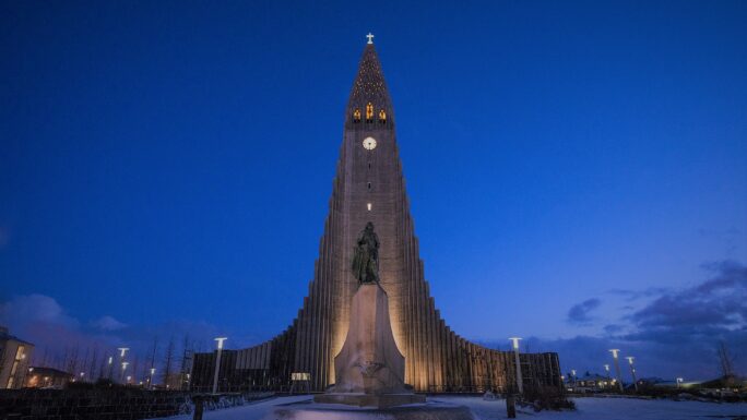
Hallgrímskirkja
50 meters, artificial terrain
Reykjavík’s landmark church (75 m), designed to resemble basalt columns – a symbol of modern Icelandic architecture.
Lambárfoss
50 meters, terrain
A quiet waterfall in southern Iceland hidden in green landscapes, accessible by a short walk from the road.
Lóndrangar
50 meters, developed terrain
Two basalt sea stacks (61 m and 75 m) rising from the ocean on Snæfellsnes – home to many nesting birds.
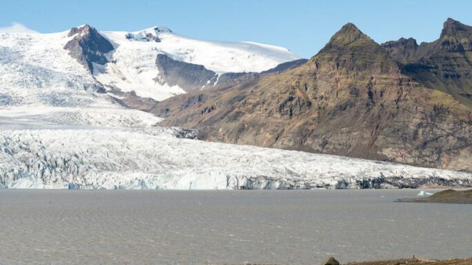
Jökulsárlón!!!!!
20 meters, terrain
Iceland’s largest glacial lagoon with floating icebergs – one of the country’s most visited locations.
Klifbrekkufossar
50 meters, difficult terrain
A cascading waterfall system in Mjóifjörður fjord in eastern Iceland, accessible via a challenging route.
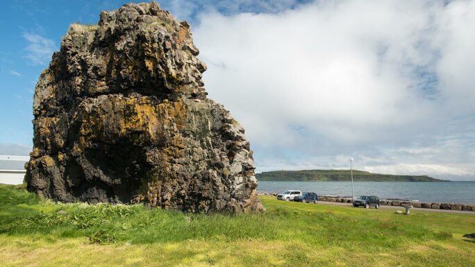
Kerlingín
50 meters, developed terrain
A rock formation shaped like a witch (“old woman”) on the Hvammsfjörður fjord in western Iceland.
Kerið
100 meters, developed terrain uphill
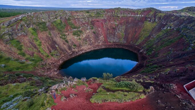
A volcanic crater with dark slopes and a emerald-colored lake at the bottom – a stop on the Golden Circle.
Kálfshamarsvík
200 meters, terrain
A scenic cove in northern Iceland with basalt columns and incredibly photogenic coastline.
Hofsós basalt columns
100 meters, stairs
Basalt columns in a small bay below the village of Hofsós with stairs leading down to the fjord shore.
Herdísarvík
100 meters, terrain
An abandoned bay on the Reykjanes peninsula with a black beach and old fishing huts.
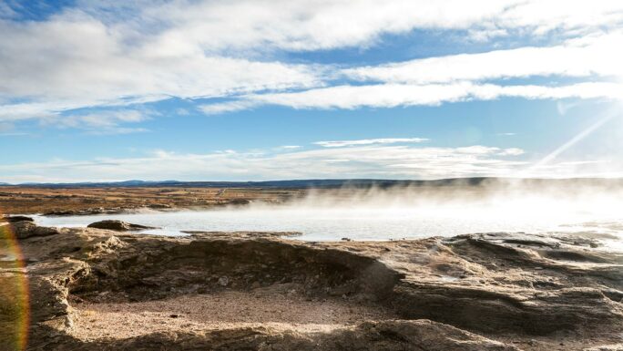
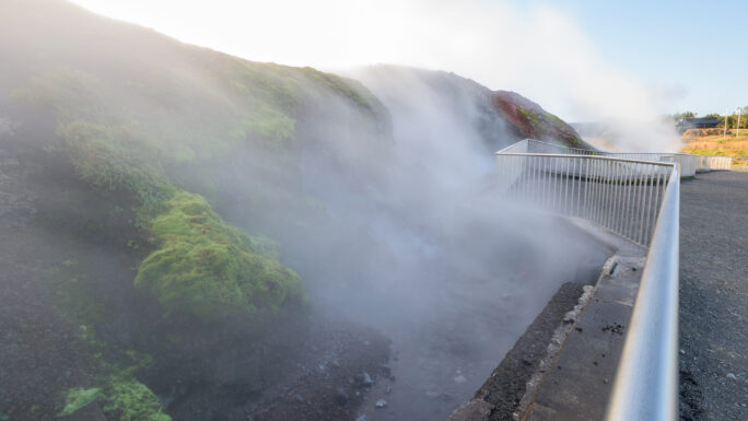
Gunnuhver!!
100 meters, developed terrain
The largest geothermal mud pool in Iceland, located on the Reykjanes peninsula and named after the ghost Gunna.
Gljúfursárfoss
100 meters, terrain
A waterfall hidden in a narrow gorge near Seljalandsfoss – reached by crossing a stream.
Gigjukvísl bridge memorial
150 meters, artificial terrain
Remains of a bridge destroyed in the 1996 Grímsvötn eruption – a reminder of Icelandic glacial floods.
Fagrifoss
200 meters, terrain
A beautiful waterfall in the Fjallabak area, far from tourist routes – its name means “beautiful waterfall.”
Ægissíðufoss
100 meters, terrain
A modest waterfall in southern Iceland hidden in wild nature off the main tourist routes.
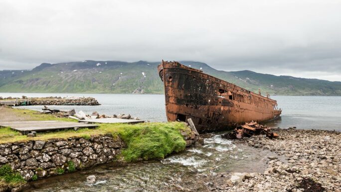
Shipwreck Djúpavík
100 meters, terrain
The wreck of the fishing vessel Suðurland stranded near Djúpavík bay in the Westfjords by an abandoned herring factory.
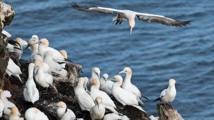
Stóri Karl
100 meters, stairs
A coastal rock where gannets nest.
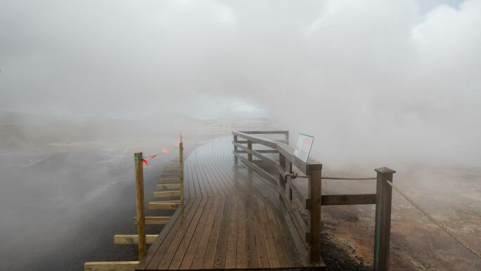
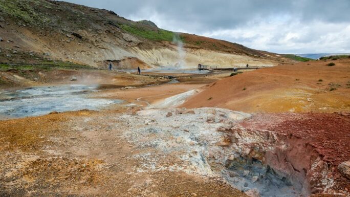
Hverir Námaskarð!!
150 meters, developed terrain
A geothermal area with mud pools, fumaroles, and sulfuric steam near Mývatn.
Fossalar
100 meters, terrain
A waterfall near Kirkjubæjarklaustur in southern Iceland flowing through green landscapes.
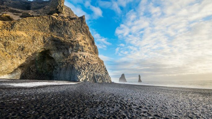
Reynisfjara!!
100 meters, terrain
World-famous black sand beach with basalt columns, Reynisdrangar sea stacks, and dangerous waves.
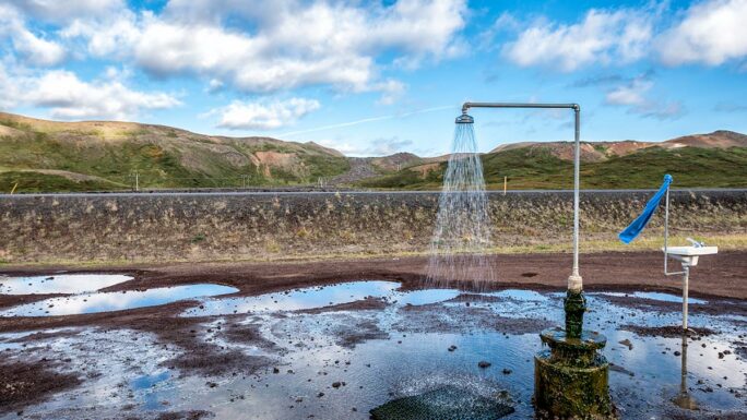
Krafla geothermal shower
20 meters, developed terrain
A natural geothermal shower near Krafla where hot water emerges directly from the ground.
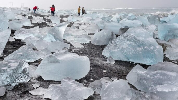
Diamond Beach!!
150 meters, terrain
A black sand beach near Jökulsárlón lagoon scattered with icebergs like giant diamonds.
Stórhöfði (Heimaey)??
200 meters, terrain
The southernmost point of the Vestmannaeyjar islands with strong winds and one of the world’s largest puffin colonies.
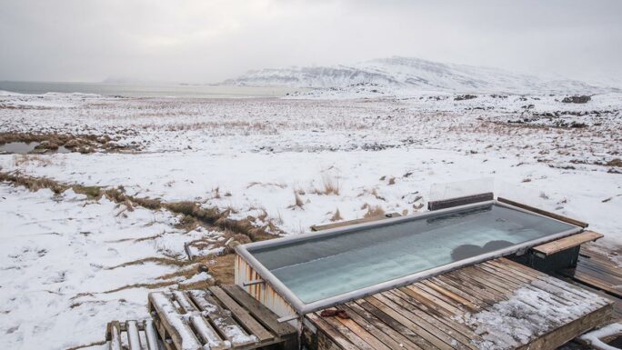
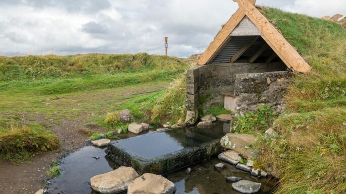
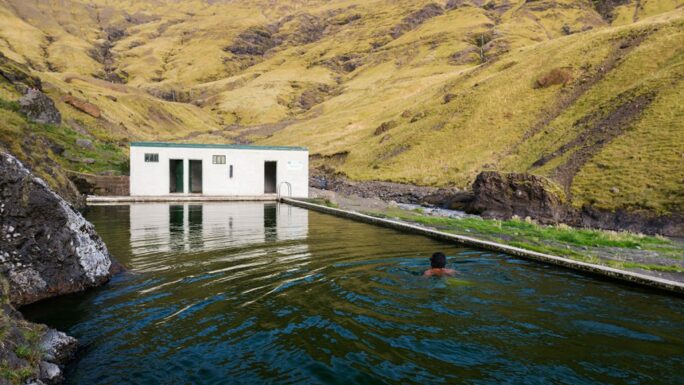
Reykjafjarðarlaug
30 meters, developed terrain
An abandoned geothermal pool in the remote Reykjafjörður fjord in the Westfjords.
Kvika
50 meters, developed terrain
A modern geothermal outdoor pool on Reykjavík’s coast with views of the sea and Mount Esja.
Stokksnes beach
50 meters, terrain
A black sand beach on the Stokksnes peninsula with panoramic views of Vestrahorn mountain.
Hjálparfoss
50 meters, developed terrain
A double waterfall in Þjórsárdalur valley flowing into a basalt-columned pool – “hjálp” means help.
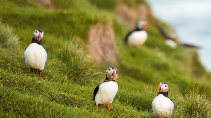
Hafnarhólmi!!!
350 meters, developed terrain, stairs
A viewing platform in Borgarfjörður eystri where Iceland’s largest puffin colony nests.
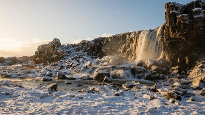
Öxarárfoss
490 meters, developed terrain, stairs
A waterfall on the Öxará river where water falls into a tectonic rift.
Seltún Krýsuvík
250 meters, developed terrain
An active geothermal area on the Reykjanes peninsula with colorful mud pools, sulfur steam, and yellow minerals.
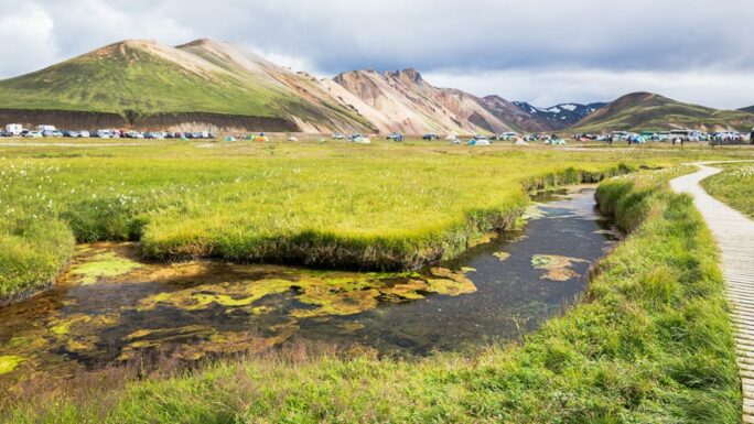
Landmannalaugar!!
100 meters, developed terrain
A colorful highlands area with rhyolite mountains, natural hot springs, and the starting point of the Laugavegur trek.
Kolufossar!
100 meters, terrain
A wild waterfall in Kolugljúfur canyon in northern Iceland with steep cliffs and dramatic views.
Kolugljúfur!
100 meters, terrain
A dramatic canyon in northern Iceland with basalt walls and waterfalls on the Víðidalsá river.
Hrunalaug
150 meters, terrain
A small natural geothermal pool in southern Iceland with scenic mountain views.
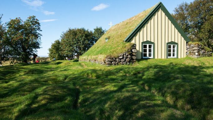
Hófskirkja
50 meters, developed terrain
One of the last preserved turf churches in Iceland (19th century) in the Öræfi region.
Gjáin (viewpoint)
50 meters, terrain
A magical valley with waterfalls and lava caves in Þjórsárdalur, popular with filmmakers.
Folaldafoss
30 meters, terrain
A small waterfall near the Öxi mountain pass in eastern Iceland.
Urriðafoss
50 meters, developed terrain
Iceland’s largest waterfall by water flow on the Þjórsá river, despite its modest height.
Þórufoss
300 meters, terrain
A lesser-known waterfall in southwest Iceland hidden in natural landscapes far from busy routes.
Þjófafoss
50 meters, terrain
A historic waterfall on the Þjórsá river whose name (“thieves’ waterfall”) comes from its past use as an execution site.
Systrafoss
100 meters, terrain
A waterfall flowing from Lake Systravatn above Kirkjubæjarklaustur, linked to legends of nuns.
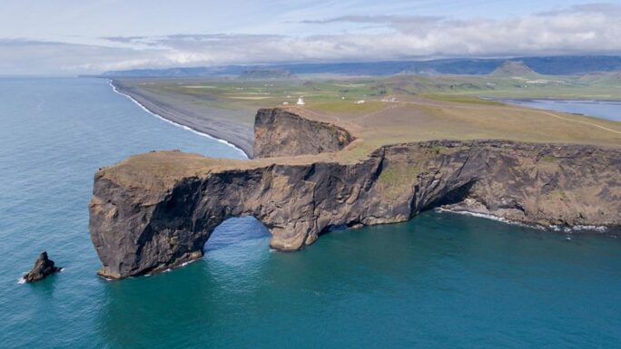
Dyrhólaey
150 meters, developed terrain
A volcanic promontory with a natural arch in southern Iceland overlooking the black sand coast.
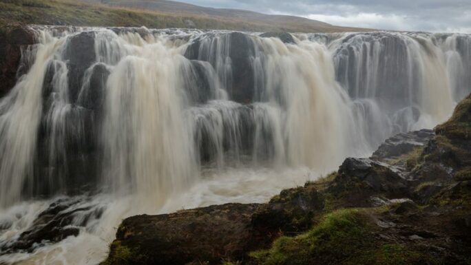
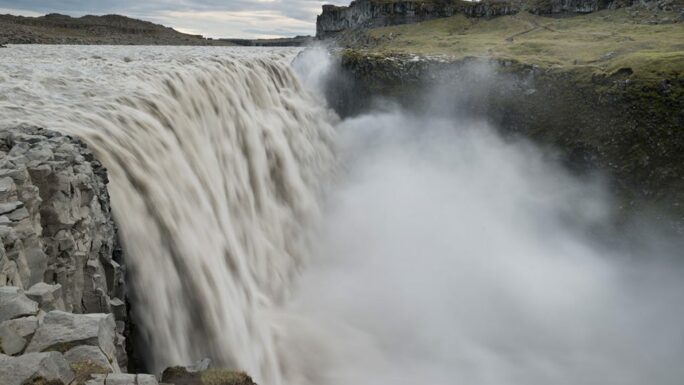
Dettifoss
West 900 meters, terrain; east 650 meters, terrain
The most powerful waterfall in Europe (44 m high, 100–500 m³/s) in northeast Iceland, accessible from both sides of the canyon.
Stjórnarfoss
200 meters, terrain
A hidden waterfall near Kirkjubæjarklaustur accessible through a meadow – a quiet and scenic southern Iceland spot.
Sigöldufoss
100 meters, terrain
A waterfall in the Sigöldugljúfur area of the central highlands – clear water cascading over basalt steps.
Fosslaug
500 meters, terrain
A natural geothermal pool near Reykjafoss waterfall in northern Iceland – a combination of hot water and nature.
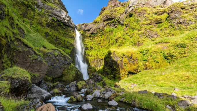
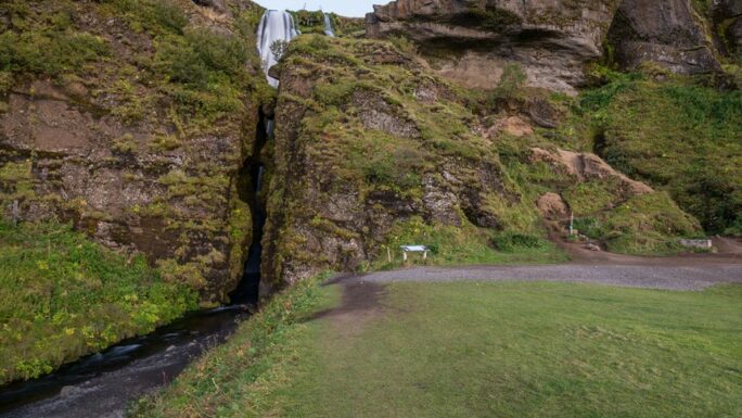
Kvernufoss
650 meters, developed terrain
A hidden 30 m waterfall behind Skógafoss, accessible via a longer trail with fewer tourists and a walk behind the curtain of water.
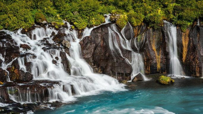
Hraunfossar
100 meters, developed terrain
A unique waterfall in western Iceland where water flows directly from a lava field into the Hvítá river over 900 meters.
Háifoss!
150 meters, terrain
Iceland’s third-highest waterfall (122 m) in the Fossá canyon with dramatic views from the edge.
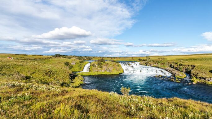
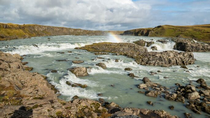
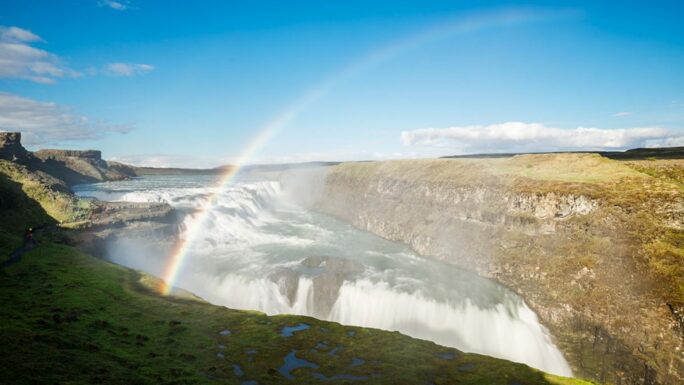
Gullfoss
250 meters, developed terrain
An iconic two-tier waterfall on the Hvítá river – the “Golden Falls” is a central attraction of the Golden Circle.
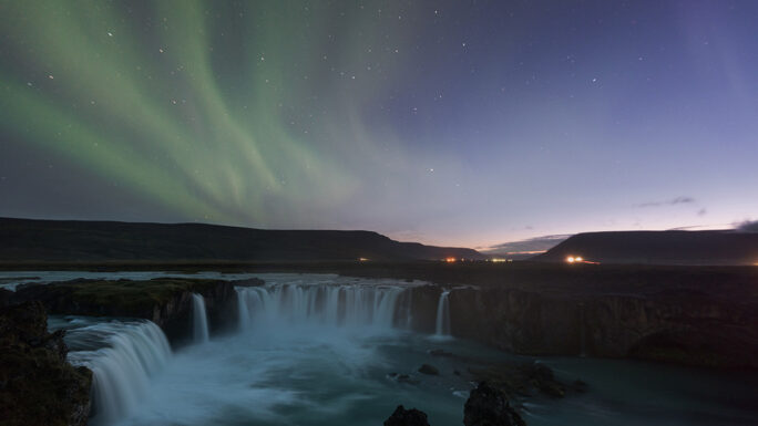
Goðafoss
200 meters, developed terrain
A horseshoe-shaped waterfall in northern Iceland (12 m) linked to Iceland’s conversion to Christianity in the year 1000 – the “Waterfall of the Gods.”
Gluggafoss
1500 meters, terrain
An impressive waterfall with “windows” in the rock in southern Iceland, accessible via a longer but easy hike.
Gljúfrabúi
500 meters, terrain
A waterfall hidden inside a narrow cliff canyon near Seljalandsfoss – reached by stepping through a stream and rock opening.
Glanni
400 meters, developed terrain
A beautiful waterfall on the Norðurá river in northwest Iceland, popular for salmon fishing.
Foss á Síðu
20 meters, developed terrain
An unusual waterfall in southern Iceland where water can spill across a road and farm during strong winds.
Fjallsárlón!
500 meters, terrain
A less visited glacial lagoon near Fjallsjökull glacier – a quieter alternative to Jökulsárlón.
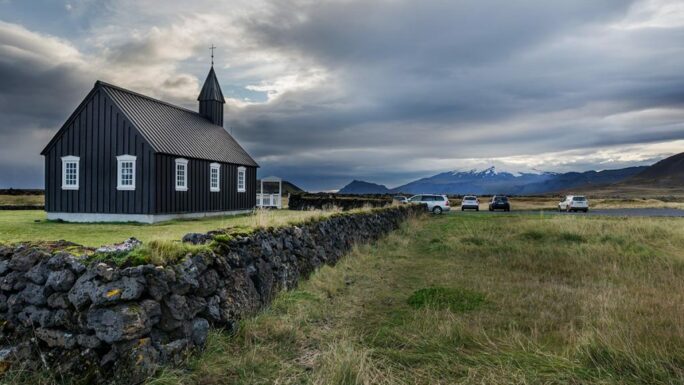
Búðakirkja
50 meters, developed terrain
An iconic black wooden church standing alone on the lava field of Búðahraun on Snæfellsnes.
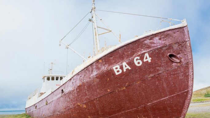
Garðar BA64
50 meters, terrain
The largest preserved wooden shipwreck in the world, a fishing trawler resting on a beach in the Westfjords near Patreksfjörður.
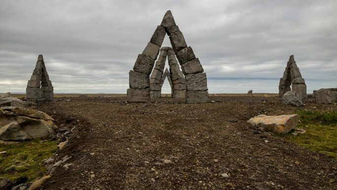
Arctic Henge
200 meters, artificial terrain
A modern stone monument inspired by Stonehenge in northern Iceland, designed for viewing the midnight sun.
Aldeyjarfoss
300 meters, uphill terrain
A waterfall surrounded by perfectly shaped basalt columns in northern Iceland – a geological marvel.
Litli-Bær
100 meters, artificial terrain
A seal-watching viewpoint on the northern coast of the Westfjords.
Látrabjarg
150 meters, terrain
One of the westernmost points of Europe, with massive cliffs home to millions of seabirds, including puffins.
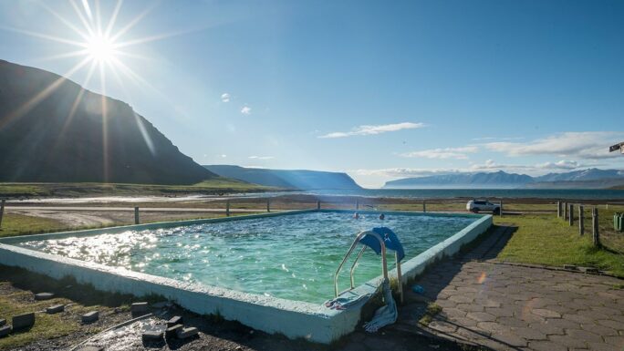
Seljavallalaug
890 meters, terrain
Iceland’s oldest geothermal swimming pool (1923), hidden in a mountain valley in the south and accessible by hiking across a stream.
Main attractions on the route


Meet an experienced guide in Iceland
10 seasons of experience. 99% chance of nice weather and places you didn't know existed.
