Weekly Itinerary – Ring Road
Main attractions
Þingvellir · Haukadalur · Strokkur · Gullfoss · Seljalandsfoss · Skógafoss · Dyrhólaey · Dyrhólaey lundi · Reynisfjara · Lómagnúpur · Svartifoss · Svínafellsjökull · Fjallsárlón · Jökulsárlón · Breiðamerkursandur · Vestrahorn · Hverir (Námaskarð) · Grjótagjá · Hverfjall · Goðafoss · Akureyri
Further attractions
Öxarárfoss · Silfra · Geysir · Gljúfrabúi · Seljavallalaug · Kvernufoss · Sólheimajökull · Vík í Mýrdal · Víkurfjara · Eldhraun walking trail · Systrafoss · Kirkjugólf · Stjórnarfoss · Foss á Siðu · Dverghamrar · Fossálar · Sjónarnípa · Eystrahorn · Stapi · Blábjörg á Berufjarðarströnd · Pony’s Head Petroglyph · Abandoned village in the East Fjords · Reyðarfjörður útsýni · Egilsstaðir · Rjúkandi · Skútustaðagígar · Hrútey í Blöndu · Þrístapar · Grábrók · Glanni
Options along the way
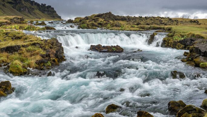
Brúarhlöð · Faxi · Kerið · Urriðafoss · Ægissíðufoss · Gluggafoss · Írárfoss · Núpsstaðakirkja · Skaftafellsjökull · Múlagljúfur · Hoffel hot tubs · Folaldafoss · Glaumbær · Víðimýrarkirkja · Fosslaug · Reykjafoss
This itinerary follows Iceland’s famous Road No. 1, the Ring Road, like a thin red line, and introduces you to everything that awaits if you set off in the footsteps of the millions of people who have explored Iceland on this very route before you. With a slight exaggeration, you could say that if you just keep driving straight on Road No. 1 you’ll manage fine — but actually, right from the start I have a good suggestion for you: take a slightly different route and enjoy Iceland to the fullest.
A week on the RR is both too little and not. I’ve spent years exploring Iceland myself and still haven’t been everywhere, so you could say that ten years isn’t enough for Iceland. On the other hand, if you don’t mind spending five hours a day behind the wheel — and it has to be said that you’ll see a lot of beautiful things even while driving — you can cover everything quite comfortably. And the chances of you returning to Iceland are pretty high.
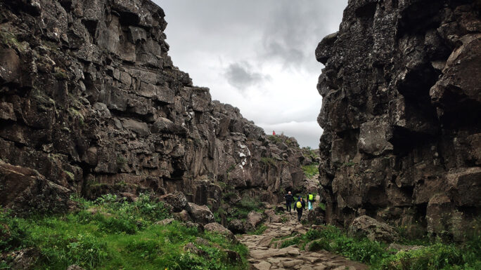
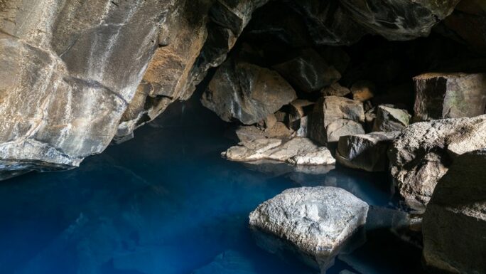
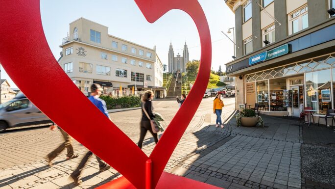
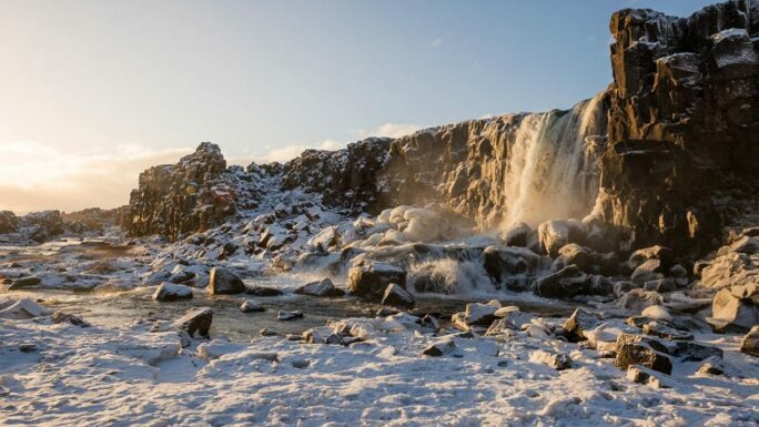
The Icelandic Ring Road is 1,332 kilometres long, starts in Reykjavík, and unlike most roads that lead from somewhere to somewhere else, this Icelandic road not only begins in Reykjavík but also ends there. Straight from Reykjavík we head north on Road No. 1 and turn off on Road 36 towards the national park Þingvellir — the place where the first modern parliament convened in 930, where the European and North American tectonic plates meet, and where you’ll find the waterfall Öxarárfoss and the fissure Silfra in Lake Þingvallavatn.
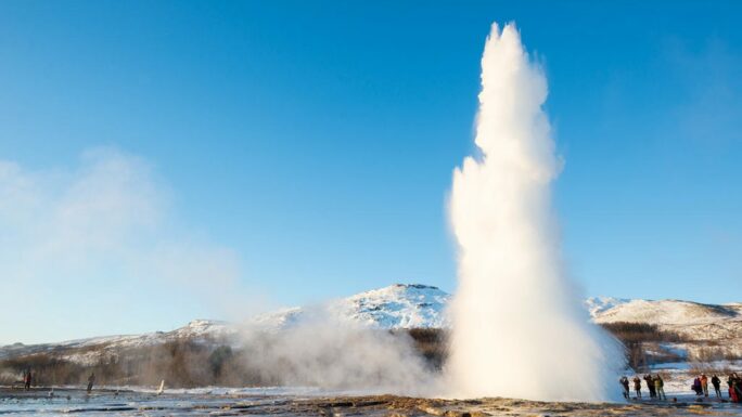
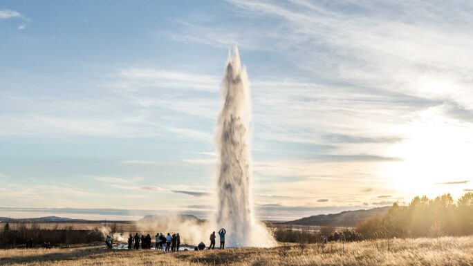
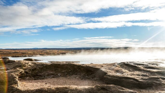
From there we head east, first to the geothermal area Haukadalur, where you can admire the geyser Strokkur roughly every 5–6 minutes, and then a little further to the
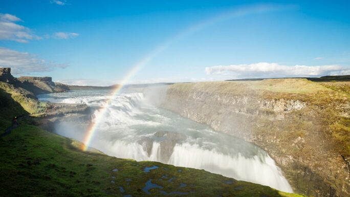
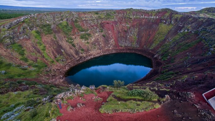
waterfall Gullfoss. Here we turn south and, with possible stops at the rocks Brúarhlöð, the waterfall Faxi and the crater Kerið, we drive into the town of Selfoss. And from there we’ll cling to the RR for dear life.
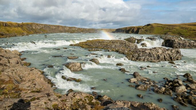
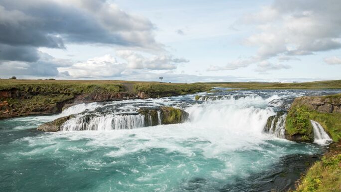
The first stop could be the waterfall Urriðafoss, or Ægissíðufoss — both are in close proximity to the RR. If you have an hour to spare, continue in the village of Hvolsvöllur on Road 261 to the waterfall Gluggafoss. Not only is the waterfall beautiful and you can stretch your legs and climb to its upper section — the view into the famous Þórsmörk area directly from Road 261 is also lovely. You don’t need to return to the RR via 261; instead head south on Road 250.
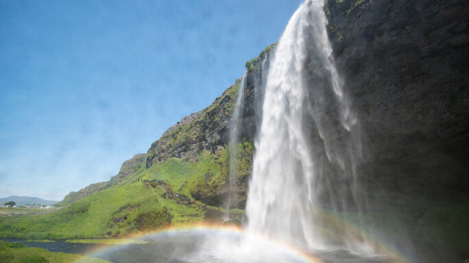
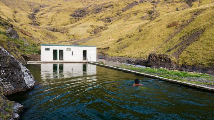
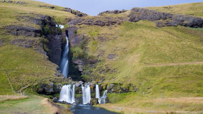
There one of Iceland’s most beautiful and most popular waterfalls awaits — Seljalandsfoss, which is interesting because you can walk behind it. Another somewhat hidden waterfall in a rock fissure is Gljúfrabúi, from where you can make your way through the fissure directly under the waterfall in about 10 minutes on foot. At both, put on waterproof clothing — you’ll need it. You can add some variety to the onward journey with a small detour to the waterfall Írárfoss and a roughly 30-minute walk to the geothermal pool Seljavallalaug — the oldest geothermal swimming pool in Iceland, lying between two glaciers.
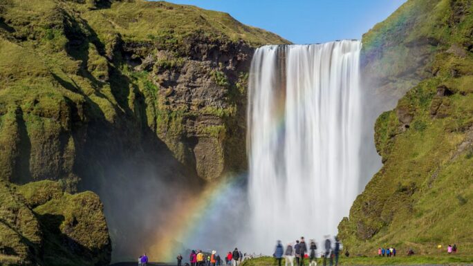
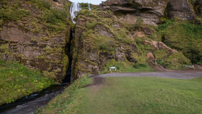
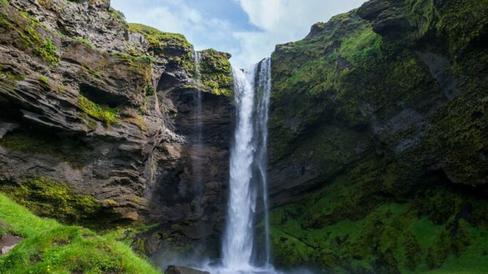
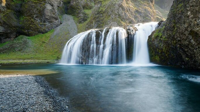
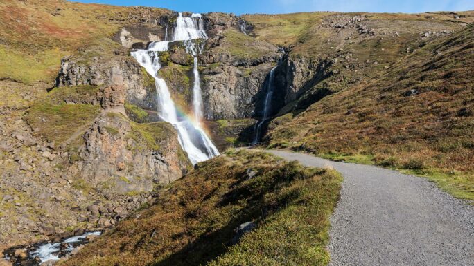
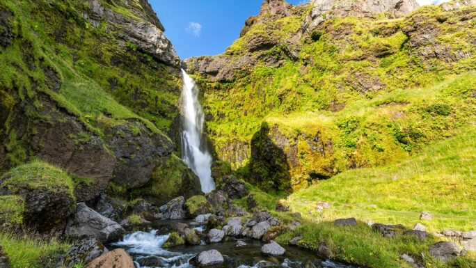
The next waterfall on the route is Skógafoss, which wages an imaginary battle with Seljalandsfoss for the title of most beautiful waterfall on the south coast. It is beautiful at all times, but comes into its own best in sunny weather — you can see a rainbow here almost always, occasionally even a double one. This spot can serve as a base for the hike along the Fimmvörðuháls trek, where there are around 20 waterfalls in 10 kilometres. Not far from Skógafoss there is also the waterfall Kvernufoss and the Skógar museum.
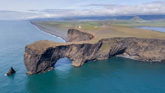
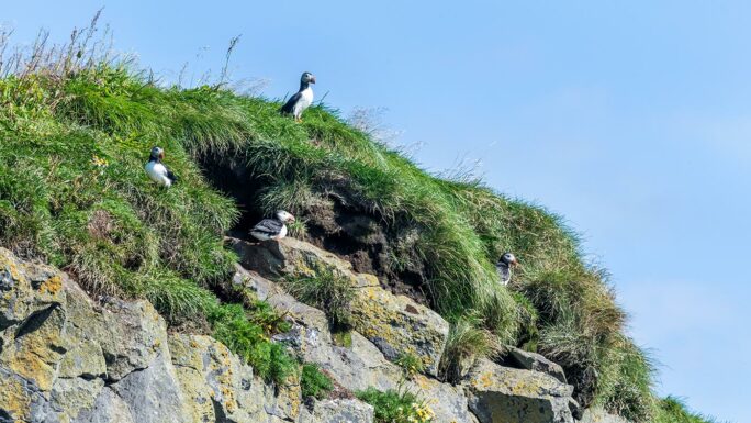
Another attraction is the glacier tongue Sólheimajökull. If you’re short on time, we’ll be seeing more beautiful glacier tongues later and you can skip this one — use the time instead for a trip to the rock arch Dyrhólaey, the southernmost point of the Icelandic mainland, and to watch puffins (May to August) at the viewpoint on its eastern slopes.
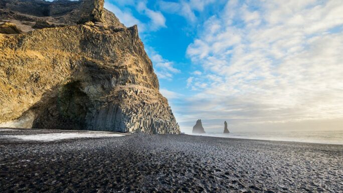
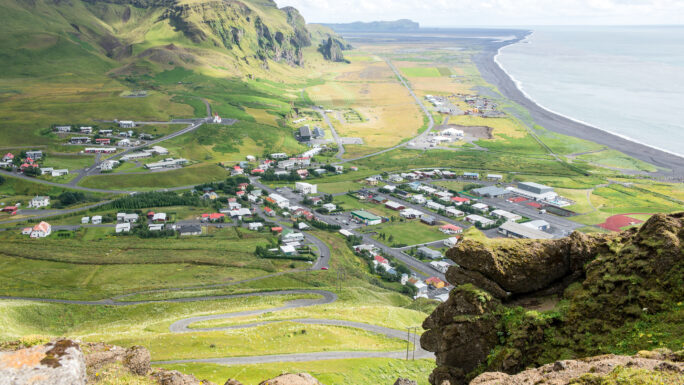
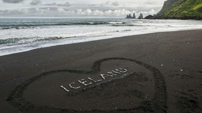
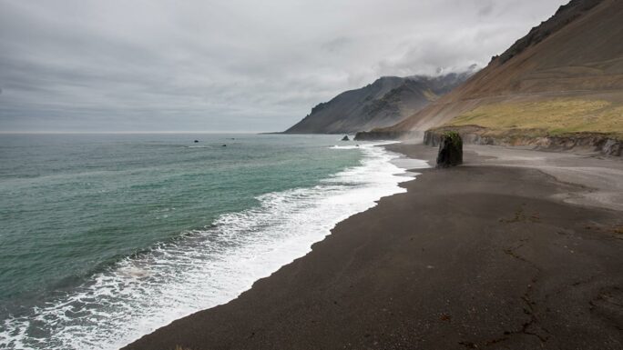
And then a few kilometres later we have the famous black beach Reynisfjara. It experienced a major landslide in early 2026 and has changed beyond recognition for those who knew it before. Next we arrive at the town of Vík í Mýrdal with its famous little church and the beach Víkurfjara.
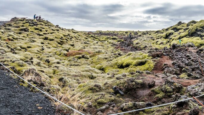
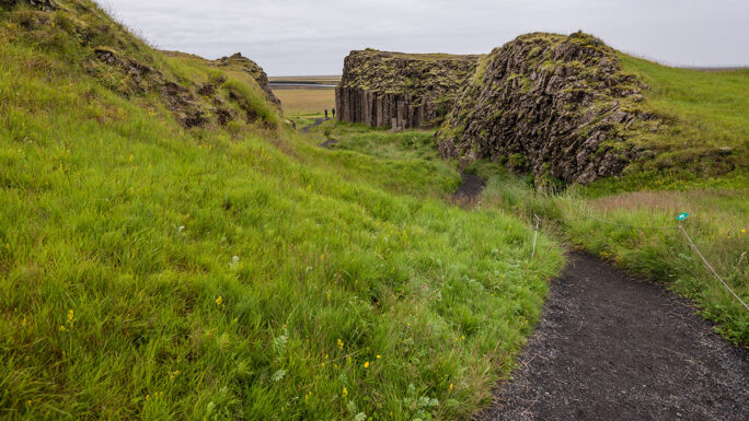
Vík marks the end of the section where the landscape looks more or less the same throughout. Now heading east, right up until we reach the East Fjords, comes a stretch where the landscape changes completely roughly every 20 kilometres. It’s fascinating, and this section is the most interesting to drive. A long drive awaits us, and just before Kirkjubæjarklaustur we’ll stop at the Eldhraun lava field — a lava field of truly apocalyptic proportions, the result of an eruption lasting eight months.
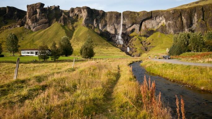
On the approach to Kirkjubæjarklaustur you’ll see the waterfall Systrafoss on the left; there is also the basalt floor Kirkjugólf and the waterfall Stjórnarfoss. Along the way the waterfall Foss á Siðu and right behind it the basalt walls Dverghamrar. Then come the rapids Fossálar and a possible stop at the abandoned farm Núpsstaður with the small church Núpsstaðakirkja — the first listed building in Iceland.
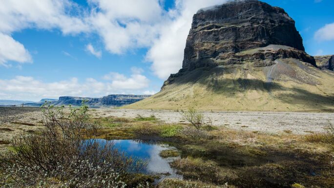
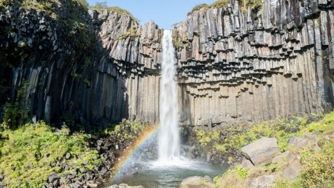
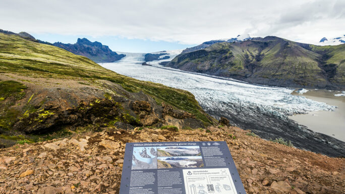
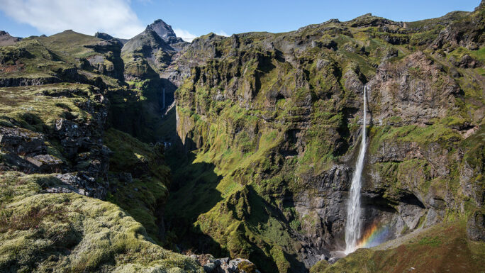
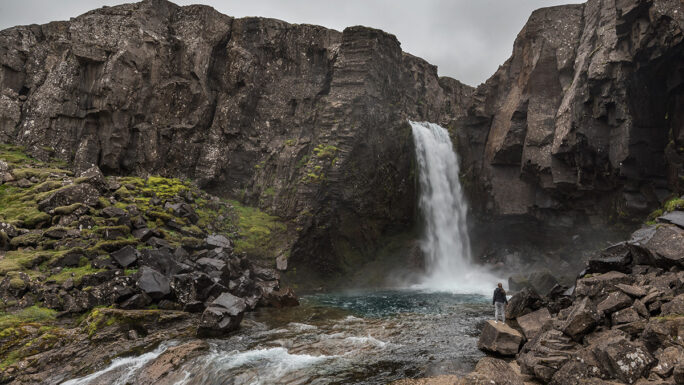
From here the mountain Lómagnúpur comes into view and will fascinate you for a long time. I don’t know with what, I don’t know why — a captivating natural formation that rises more than 700 metres from the coast. Then we arrive at the Skaftafell national park. The main draw is the waterfall Svartifoss and the viewpoint Sjónarnípa — these two places can be covered in a three-hour walk. From here you can also walk to the glacier tongue Skaftafellsjökull.
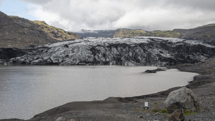
Next we arrive at the glacier tongue Svínafellsjökull, the most impressive of its kind in the area. In the hamlet of Hof you can make a short detour to the small church Hofskirkja. A bit further on there is the option of a three-quarter-hour hike to the canyon Múlagljúfur, which practically nobody knew about until 2020.
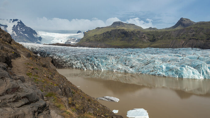
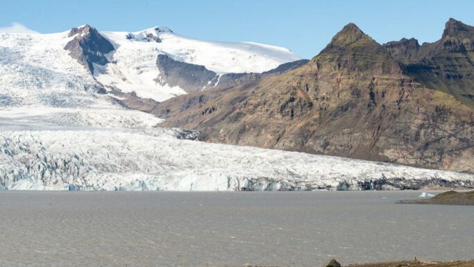
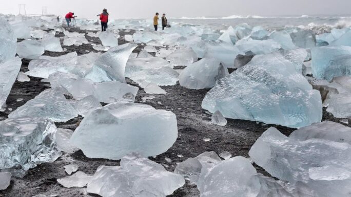
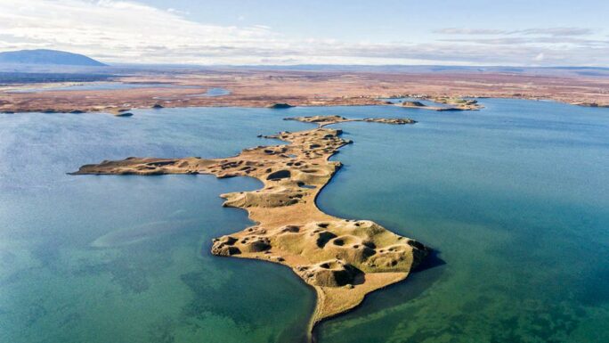
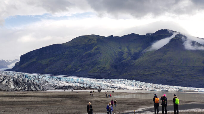
And then comes Fjallsárlón, a mountain glacier lagoon with the appealing feature that the glacier tongue is right there in front of you. About 10 kilometres further comes what is perhaps the greatest attraction of the trip — Jökulsárlón. Even after 10 years of visiting the Glacier Lagoon countless times, it has never lost its appeal for me. The experience is enhanced by the black beach Breiðamerkursandur, where the sea washes up melting chunks of ice glittering in the southern sun — hence the name Diamond Beach. The spot is popular with seals, who hunt and rest here.
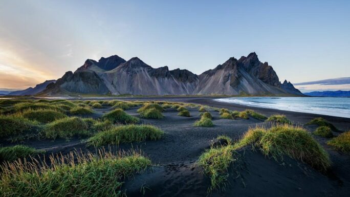
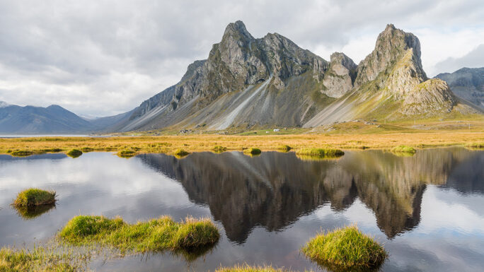
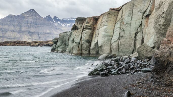
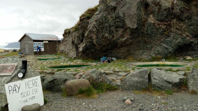
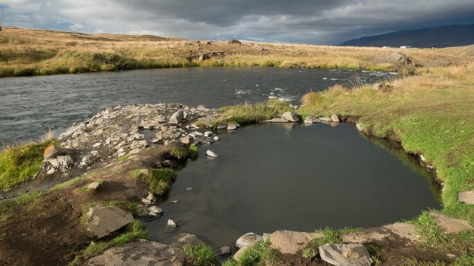
If geothermal baths appeal to you, just before Höfn you can make a detour to the Geothermal hot tubs at Hoffel, whose water comes from a deep borehole. Then follows the harbour town of Höfn. Beyond Höfn the famous Vestrahorn and the rocks of the Eystrahorn massif await us. A little beyond Eystrahorn comes a very interesting stretch of road where the route seems to carve itself into the slopes of the mountain massif — crossing this we informally leave the south coast and head into the East Fjords. Immediately there is a short stop at the bay Stapavík with a rocky pillar.
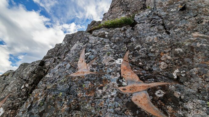
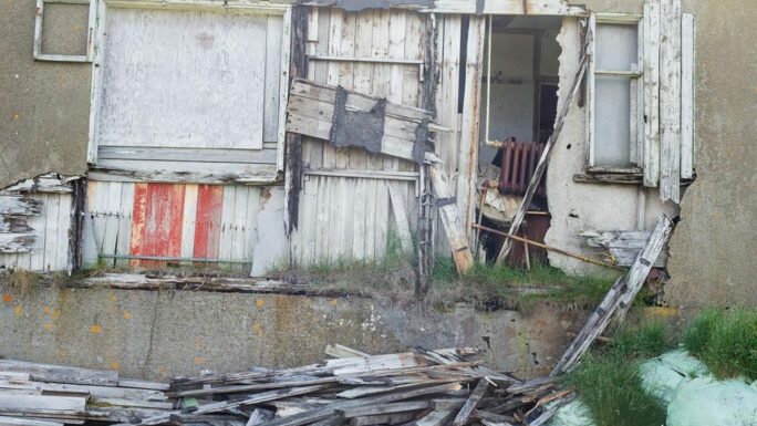
In the area are the green rocks Blábjörg á Berufjarðarströnd — yes, the rocks really are green, even though the name means Blue Cliffs. There is also the Pony’s Head Petroglyph, rock carvings that will take a little searching to find. And just around the corner is what looks at first glance like an abandoned hamlet, where our first viral video was made — but the hamlet is certainly not as abandoned as it seems. Soon comes a big decision: take the unpaved road 939 known as the Öxi pass (saving 70 km, with the waterfall Folaldafoss along the way), or continue along the ocean on the RR. In winter the Öxi pass is closed.
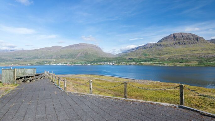
We continue through the East Fjords, enter a tunnel and immediately beyond it is the view over the town of Reyðarfjörður and the fjord of the same name. Beyond Reyðarfjörður we leave the coast and head inland — in winter, keep a close eye on road conditions and weather forecasts here. Then we have the East Iceland metropolis of Egilsstaðir, with nearly 3,000 inhabitants and two large supermarkets.
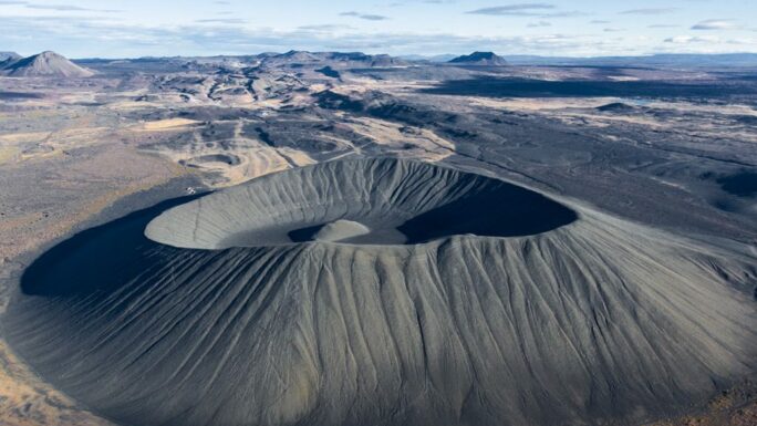
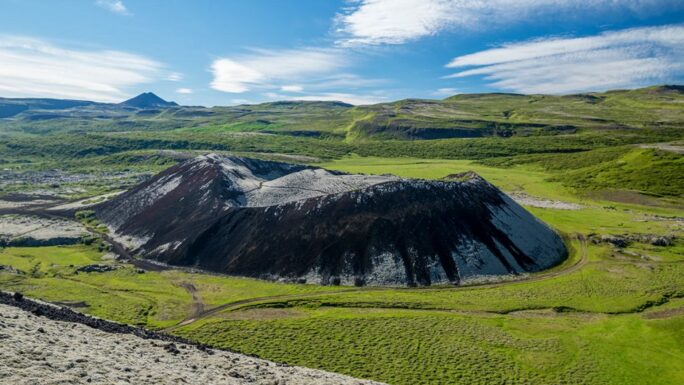
A fairly long drive awaits us, which we break up with a stop at the waterfall Rjúkandi and certainly a longer stop in the geothermal area of Hverir–Námaskarð, where it steams and reeks of sulphur quite spectacularly. And then right after the pass the entire Mývatn lake area. The most popular attractions are the cave Grjótagjá, the crater Hverfjall and the pseudo-craters Skútustaðagígar, which have a visitor centre.
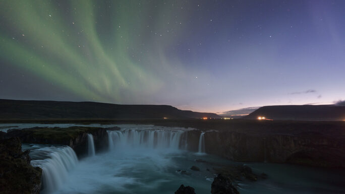
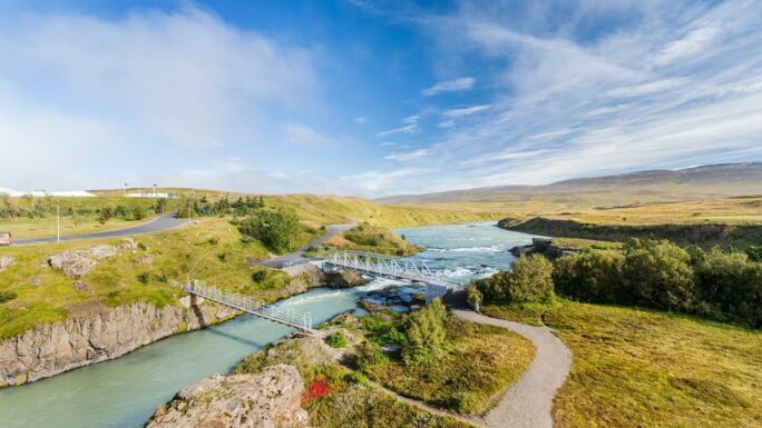
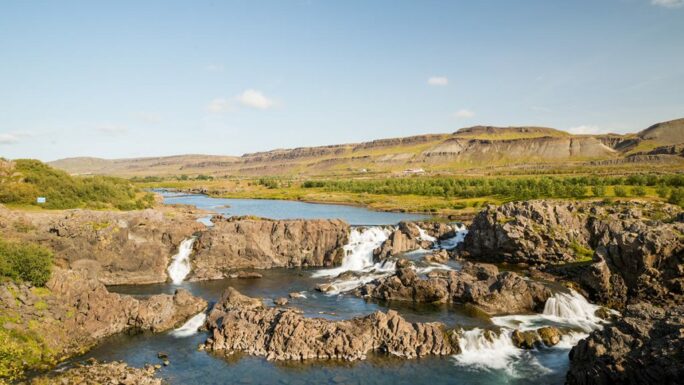
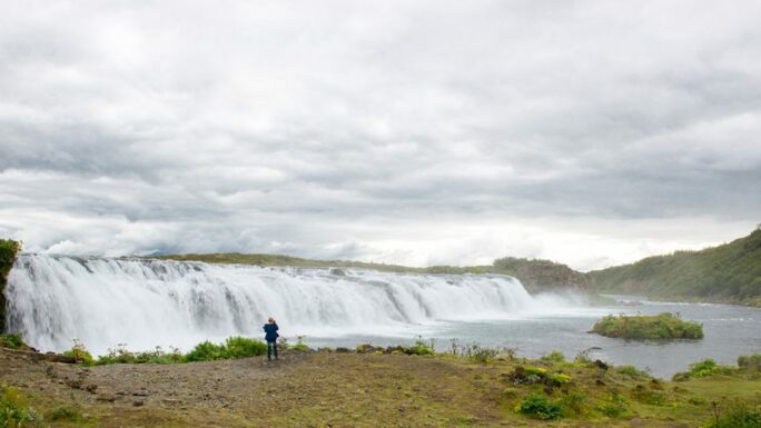
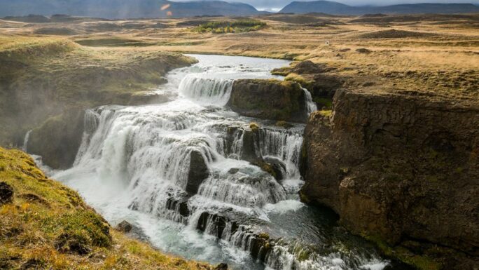
A further obligatory stop is the waterfall Goðafoss. At only 10 metres high, its pleasing horseshoe shape has an unmatched charisma. The waterfall can be
admired from both banks of the river Skjálfandafljót, and you will undoubtedly spend two or three hours here.
Next comes the drive to Akureyri, Iceland’s northern metropolis. You can go through the tunnel — currently the only toll road in Iceland — or take the old Road 84 around the peak Gautsstaðahnjúkur. Just beyond the tunnel exit is a small geothermal pool that formed as a direct result of the tunnel’s construction, with beautiful views over the fjord and the city. In Akureyri enjoy a bit of civilisation — do some shopping, freshen up. From here the journey gets a little easier again.
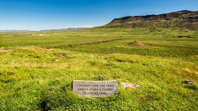
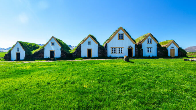
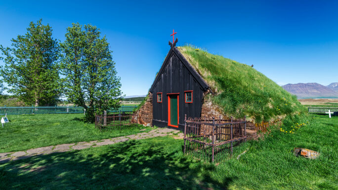
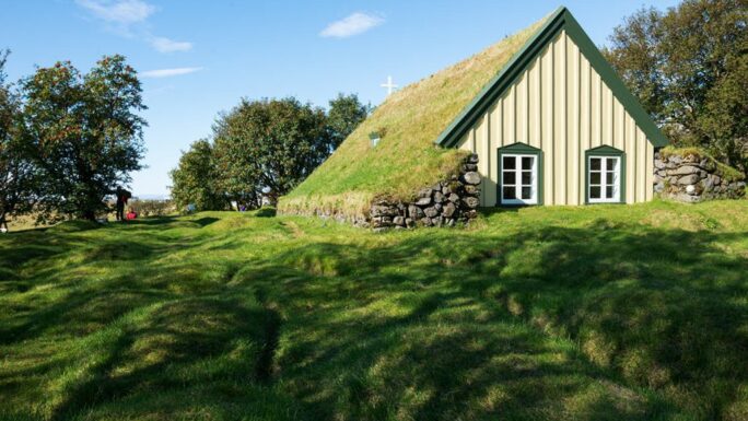
After roughly 100 kilometres, in close proximity to the RR, we have the small church Víðimýrarkirkja, the museum Glaumbær and the geothermal pool Fosslaug right next to the waterfall Reykjafoss — these require about a 20-minute walk. Then we pass through the town of Blönduós, near which there is a small island on the river Blanda called Hrútey í Blöndu with a completely continental feel. Another minor cultural landmark is Þrístapar — the site of the last execution in Iceland, with a newly reconstructed memorial.
And if this cheers you up, all that remains now are stops at the craters Grábrók and the waterfall Glanni. From there the final 100 kilometres await, 7 of which pass through an undersea tunnel, and then you’re back in Reykjavík. I hope you enjoyed it — safe travels!
Where to shop cheaply: Reykjavík, Selfoss, Hvolsvöllur, Höfn, Reyðarfjörður, Egilsstaðir, Akureyri, Borgarnes, Akranes · (Vík í Mýrdal)
Total length in km
Availability
Car needed
Main attractions on the route

Meet an experienced guide in Iceland
10 seasons of experience. 99% chance of nice weather and places you didn't know existed.
