Weekly itinerary – the most beautiful places in the south
Main attractions
Þingvellir · Strokkur · Gullfoss · Seljalandsfoss · Dyrhólaey · Reynisfjara · Eldhraun · Svartifoss · Jökulsárlón · Breiðamerkursandur · Fjallsárlón · Fjaðrárgljúfur · Eldgjá · Landmannalaugar · Sigöldugljúfur · Háifoss · Gjáin
Other attractions
Öxarárfoss · Haukadalur · Kerið · Gljúfrabúi · Íráfoss · Seljavallalaug · Kvernufoss · Sólheimajökull · Loftsalahellir · Foss á Siðu · Fossálar · Dverghamrar · Lómagnúpur · Sjónarnípa · Svínafellsjökull · Ófærufoss · Brennisteinsalda · Bláhnjúkur · viewpoint no. 8 · Frostastaðavatn · Ljótipollur · Hnausapollur · Granni · Stöng í Þjórsárdal
Options along the way
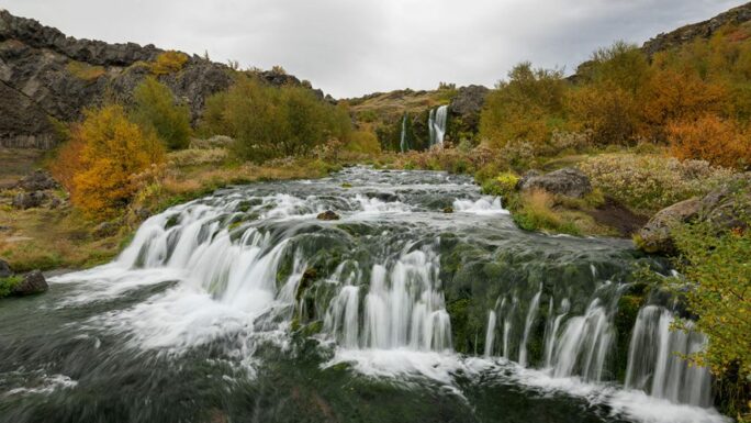
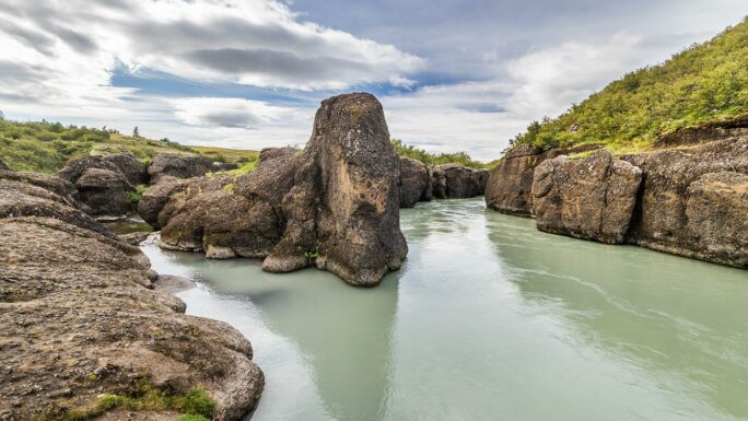
Brúarfoss · Brúarhlöð · Faxi · Ægissíðufoss · Nauthúsagil · Stigafoss · Dakota DC-3 · Víkurfjara · Uxafótafoss · Hatta · Reynisfjall · Þakgil · Remundargil · Skaftafellsjökull · Hofskirkja · Múlagljúfur · Lakagígar · Fagrifoss · Langisjór · Sveinstindur · Grænihryggur
This itinerary takes us through the most interesting locations in the southern part of Iceland. Heading east, we will follow the famous ring road – Route 1, and on the way back we will venture into the highlands and explore interesting places along the mountain road F208. Among Icelandic highland roads, F208 is one of the easier ones – yes, you will cross rivers, but these are usually quite mild. Caution while driving and awareness of current conditions are always necessary.
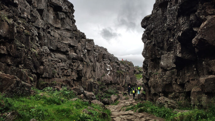
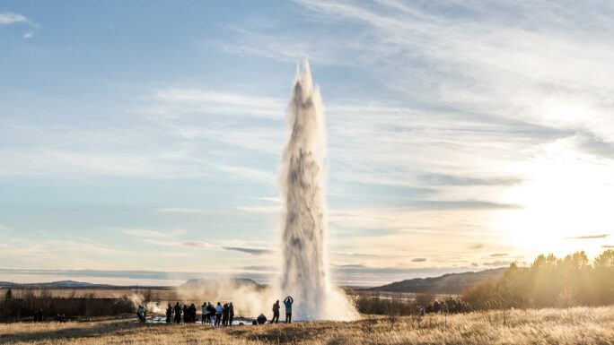
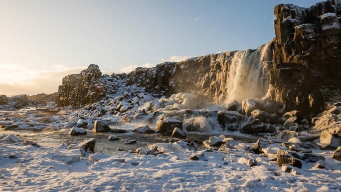
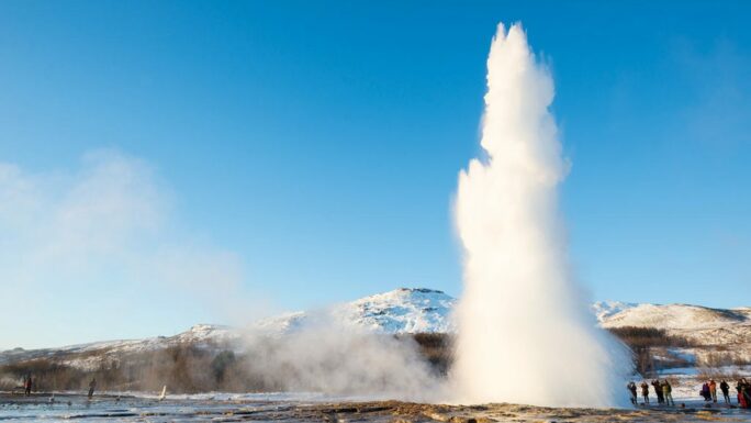
At the very beginning, we will head from Reykjavík east into the area of the national park Þingvellir, along with fissures such as Silfra and the waterfall Öxarárfoss. From there we continue east to the geothermal area Haukadalur (with an optional stop on the way at the waterfall Brúarfoss – about 120 minutes), where the geysers Geysir and Strokkur are located. Geysir is the one that gave all geysers in the world their name, although its eruptions are irregular and sometimes occur only once every few decades. The second geyser – Strokkur – is much more active, and you can expect an eruption reaching 5–40 meters every 5–6 minutes on average.
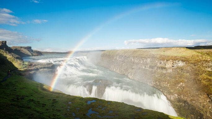
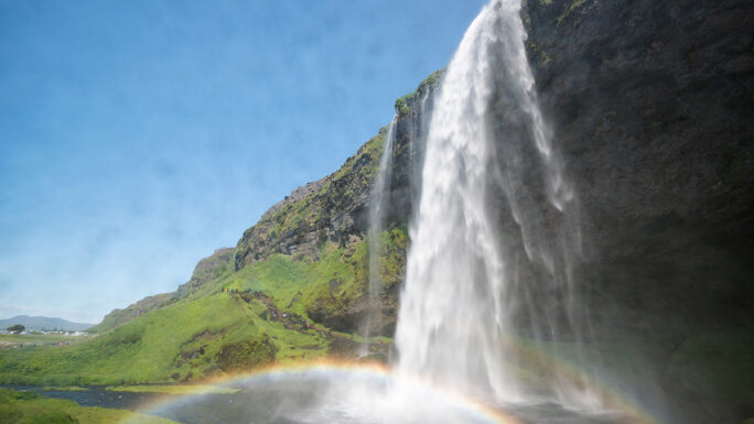
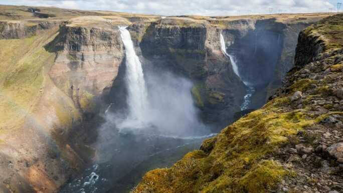
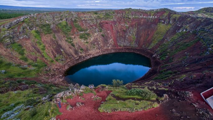
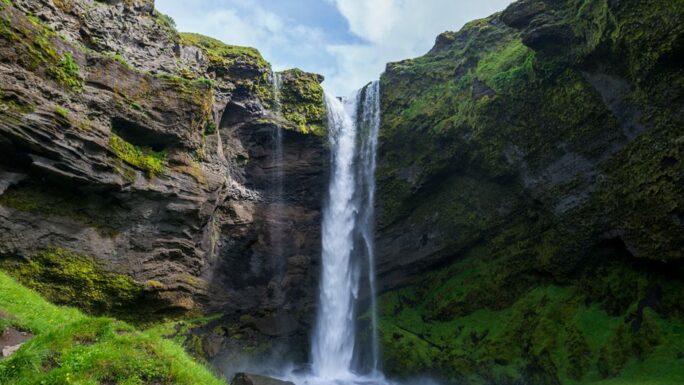
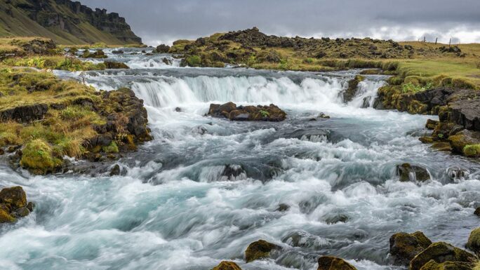
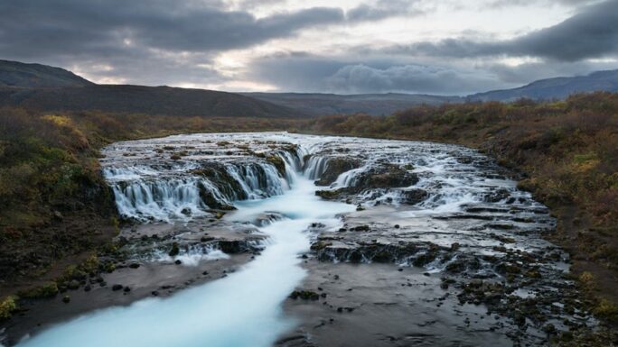
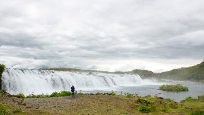
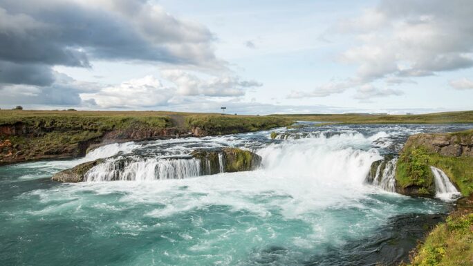
From there we go just 8 kilometers further east to the waterfall Gullfoss. Here we turn south with a possible short stop at the cliffs Brúarhlöð and the waterfall Faxi toward the crater Kerið. After that, we join the Ring Road, which we will follow far to the east. After 80 kilometers, with a possible short detour to the waterfall Ægissíðufoss, we will already see from a distance the waterfall Seljalandsfoss, whose water originates several hundred meters higher in the Eyjafjallajökull glacier. You should definitely reserve 2–3 hours here, especially since nearby there is also a waterfall hidden in the cliffs Gljúfrabúi.
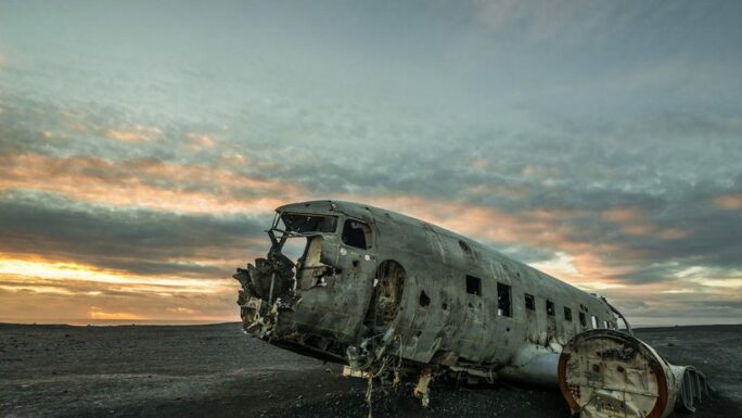
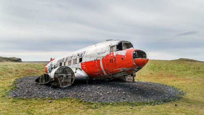
After enjoying the area, you can also take a short drive on road F249 and get your first taste of the Icelandic highlands. A popular stop is the fissure Nauthúsagil and a bit further into the highlands is the waterfall Stigafoss, which, like Seljalandsfoss, also has a cave behind it – and unlike Seljalandsfoss, you will not encounter any crowds here. Along the way there is also the wreck of the aircraft Dakota DC-3, which until recently was on the other side of Iceland, but due to tourist disturbance it was moved here. However, the main focus of our journey lies further along Route 1 from Seljalandsfoss.
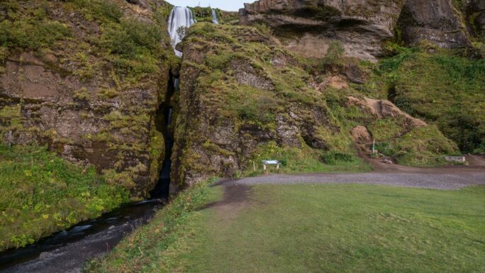
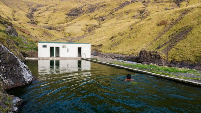
If you are already tired of tourists, you can make a short detour to the waterfall Íráfoss and, if you want to swim in a geothermal pool, you can visit the oldest swimming pool in Iceland – Seljavallalaug. From the parking area it is about a 15-minute walk. Interestingly, this place is also popular among people who ultimately do not even swim.
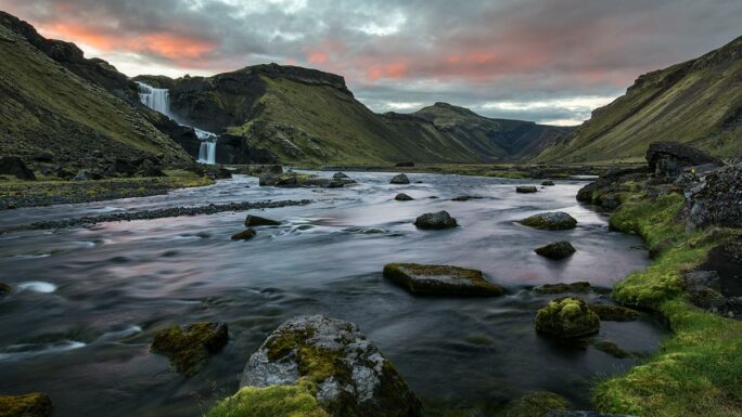
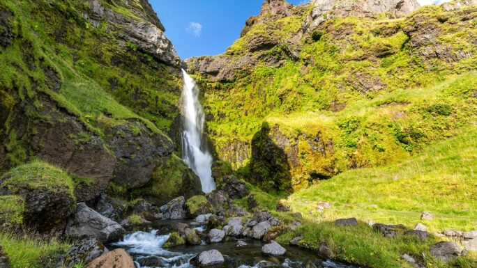
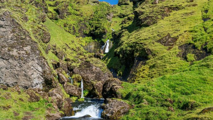
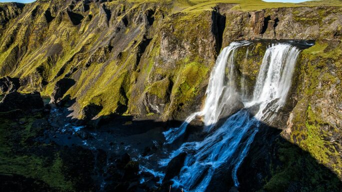
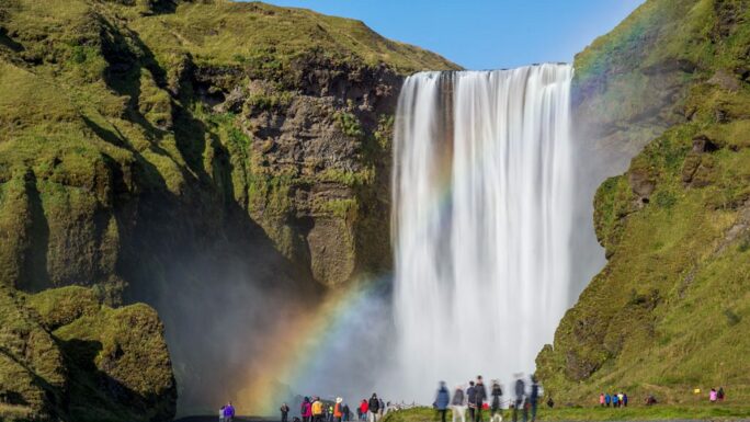
And just 10 kilometers further east awaits perhaps the greatest icon of the south coast, the waterfall Skógafoss. You can easily spend more time here than you might expect – if you walk to the top of the waterfall, you can continue upstream along the Skógá river, where there is a waterfall roughly every 300 meters for the next 6 kilometers. Nearby, by car, is the waterfall Kvernufoss, until recently quite unknown, but now with a new parking area and an improved path almost right up to the waterfall.
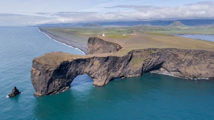
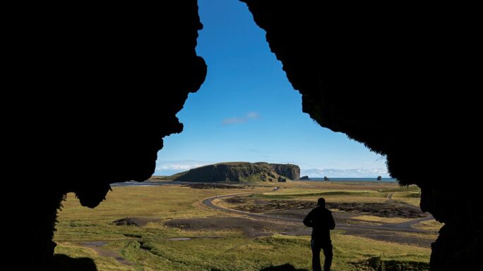
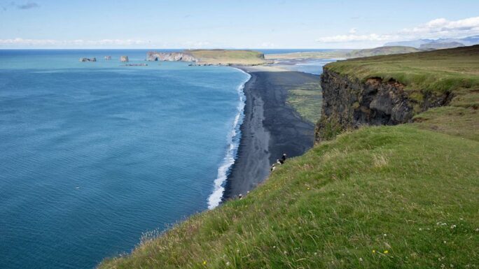
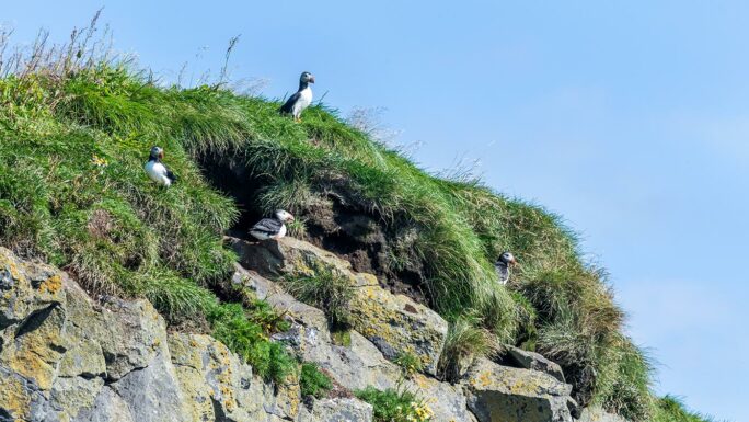
Once you are done with waterfalls, we continue. First is a detour to the glacier tongue Sólheimajökull, which will be our first direct contact with a glacier. Right across the road, on Sólheimasandur beach, lies the abandoned military version of the aircraft Dakota DC-3. Honestly, it is not really worth it, but it is your time and energy… Especially since further on we reach the rock arch Dyrhólaey, where from the lighthouse you will get truly beautiful views of the surrounding landscape and the Vestmannaeyjar islands in the sea. On the eastern side of the cliffs, in an easily accessible spot, you can also observe puffins from just a few meters away. On the way to Dyrhólaey there is also the cave Loftsalahellir, which you can reach in about 10 minutes.
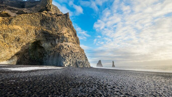
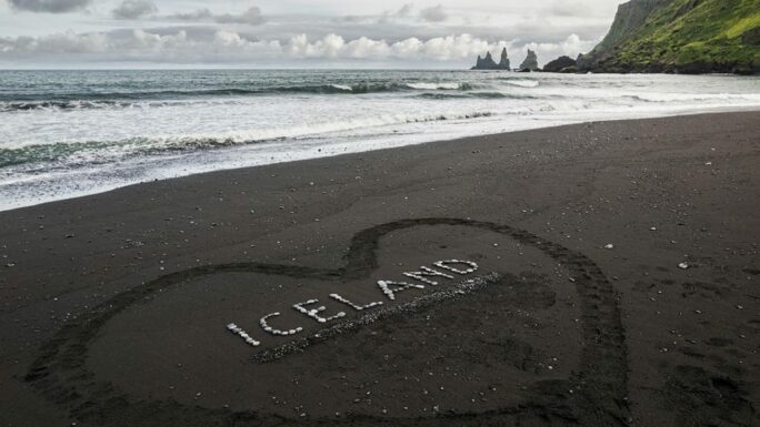
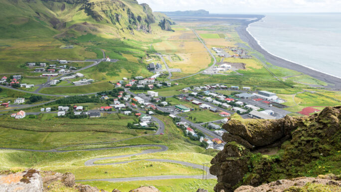
About 15 kilometers further east, we reach another icon of southern Iceland – the black sand beach Reynisfjara. Be very careful here not to get swept into the sea – and this is absolutely not a joke. Then there is the charming town Vík í Mýrdal, which offers a wide range of accommodation options. You can take a walk to the beach Víkurfjara, to the waterfall Uxafótafoss, or, if you want a longer walk, to the viewpoint Hatta or the mountain Reynisfjall.
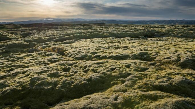
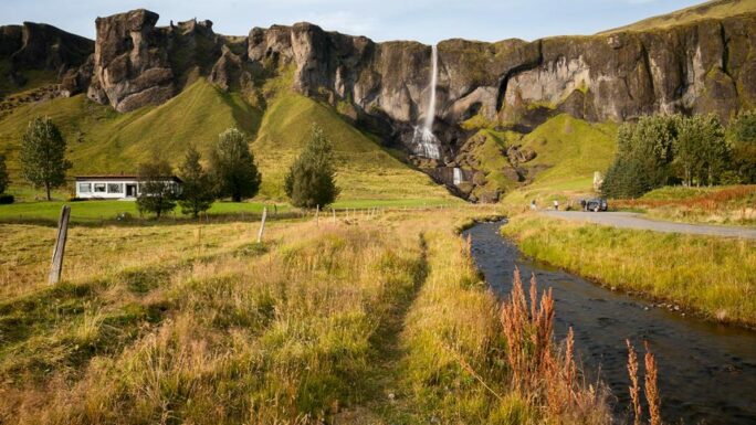
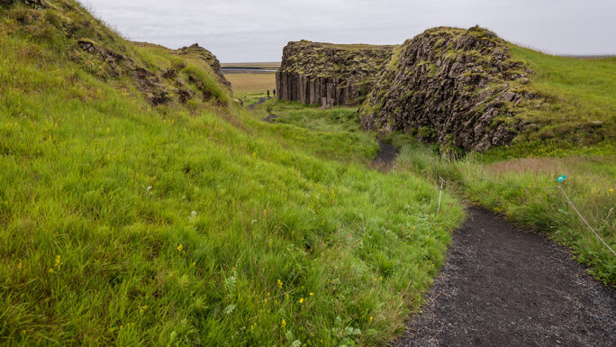
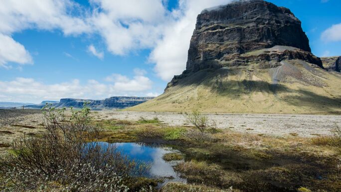
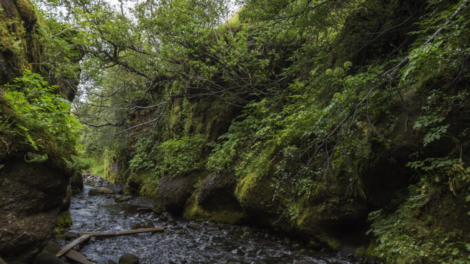
East of Vík we enter a completely new landscape. A possible detour from here is a trip inland along unpaved road 214 to the well-known canyon Þakgil, which takes about half a day. Now we face a long drive to the lava field Eldhraun, the result of an eruption in 1783 and in many places covered with a thick layer of moss. After passing the town with the difficult name Kirkjubæjarklaustur, we encounter three small attractions – the waterfall Foss á Siðu, the rapids Fossálar, and the basalt columns Dverghamrar, and a bit further the magical mountain Lómagnúpur.
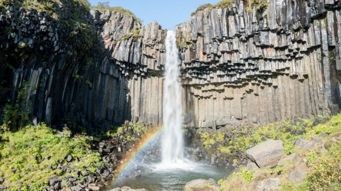
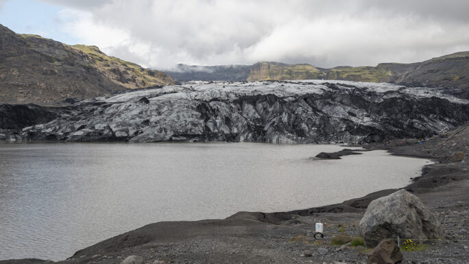
Then we arrive in the Skaftafell National Park area, where there is a large campsite. The most interesting places here are the waterfall Svartifoss and the view of the Skaftafellsjökull glacier from the viewpoint called Sjónarnípa. This route, including stops, takes about 4 hours. There is also the option to walk to the glacier tongue Skaftafellsjökull. After leaving Skaftafell, our first stop is the glacier tongue Svínafellsjökull. This glacier tongue is especially fascinating – in good weather you can clearly see tens-of-meters-deep folds in the ice in various shades of blue.
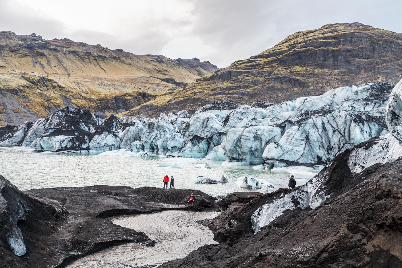
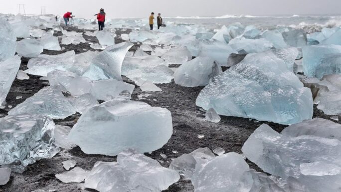
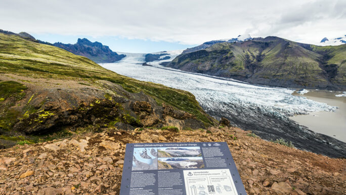
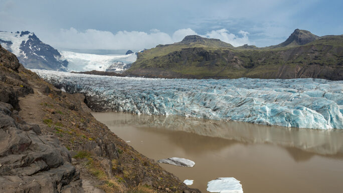
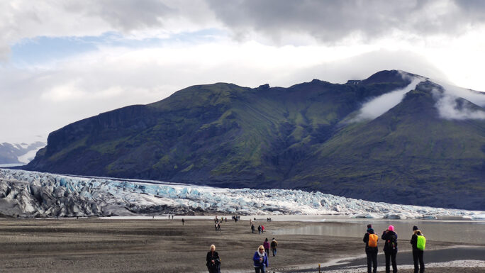
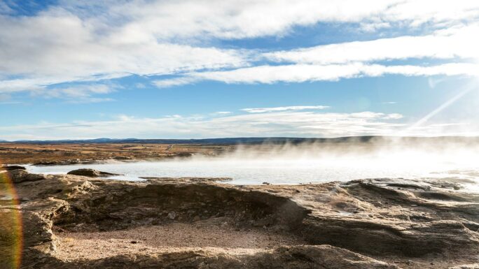
Next, we continue to the famous Glacial Lagoon, with a small detour to the church Hofskirkja. And then it happens – you cross the bridge and on the left you see Jökulsárlón, and on the right Breiðamerkursandur, better known as Diamond Beach. It is a place that never gets boring, as it changes every moment. If you do not watch the time, three to four hours will pass without you even noticing. At the lagoon you can also take boat tours to see the floating icebergs up close.
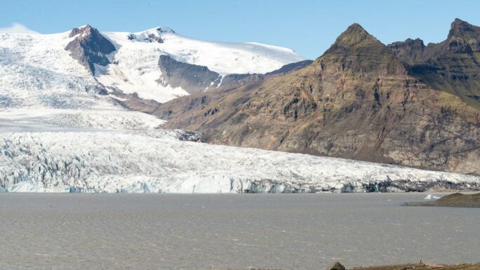
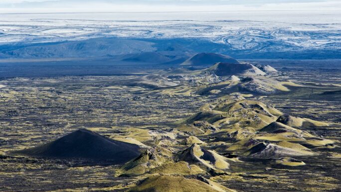
The glacial lagoon is the easternmost point of our route; now we head back. The first stop is another glacial lagoon – Fjallsárlón. Its charm lies mainly in the fact that the glacier tongue is only a few hundred meters away. From the parking lot it is about a 500-meter walk to the lagoon, and you may appreciate its more intimate atmosphere. Here too you can take boat tours. Before we turn inland, two places along the way deserve mention. The first is the canyon Múlagljúfur, famous for the view of the waterfall Múlafoss at its end – the walk from the parking lot takes about an hour, and you will spend around 3–4 hours there. The second is the first major detour inland to the craters Lakagígar, with the waterfall Fagrifoss along the way. This detour takes about 6–7 hours in total.
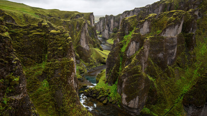
Even if you do not go to Lakagígar, shortly after the town Kirkjubæjarklaustur we make a short detour to the stunning canyon Fjaðrárgljúfur. This place, made famous by Game of Thrones and a Justin Bieber music video, would deserve a spot on any itinerary anyway – according to Icelanders, it is the most beautiful canyon in the world. We return briefly to Route 1 and after a few kilometers continue to road 208, which soon turns into F208. Here we first encounter rougher terrain and river crossings.
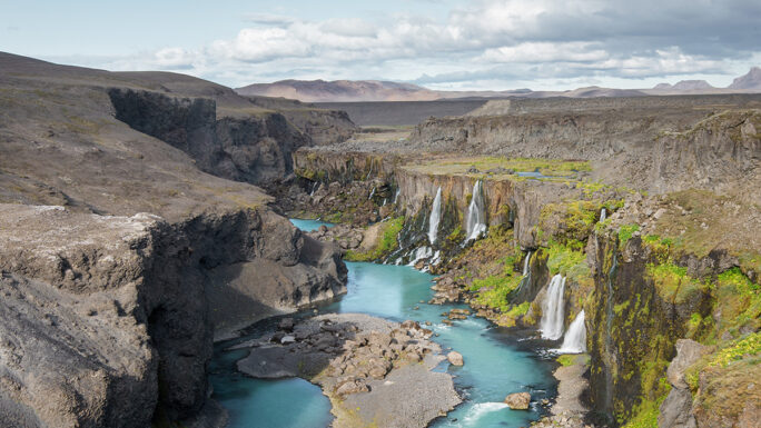
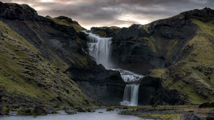
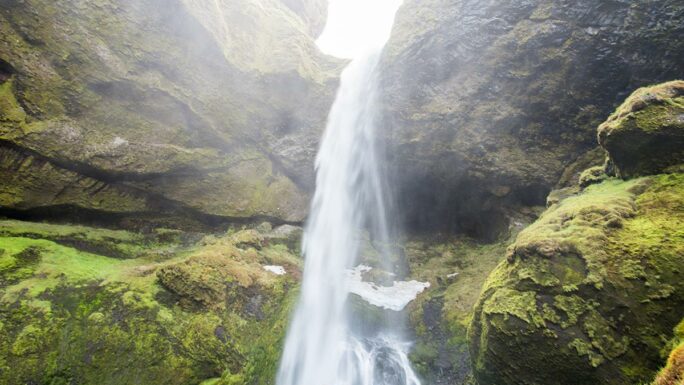
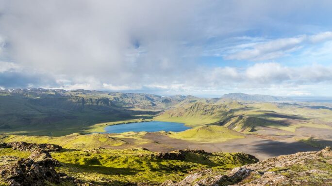
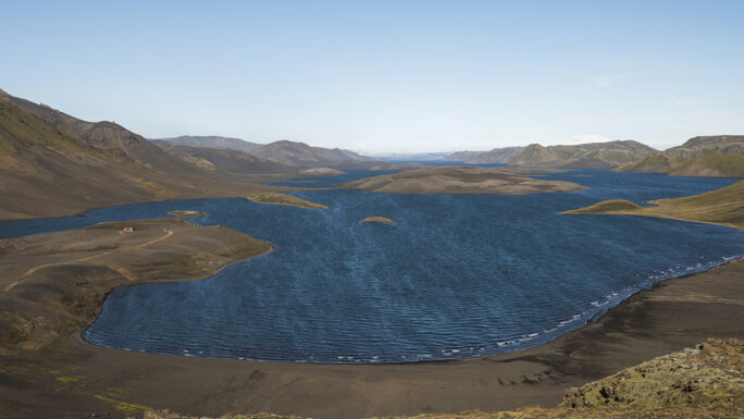
The biggest highlight before reaching Landmannalaugar is the canyon Eldgjá. This enormous volcanic canyon stretching for tens of kilometers can be explored on foot – the hike to the waterfall Ófærufoss is unforgettable. We return to F208 and continue inland. Along the way there are two possible detours – road F235 to the lake Langisjór, with the mountain Sveinstindur (6–7 hours), and a more difficult hike to the ridge Grænihryggur (also about 6–7 hours of walking).
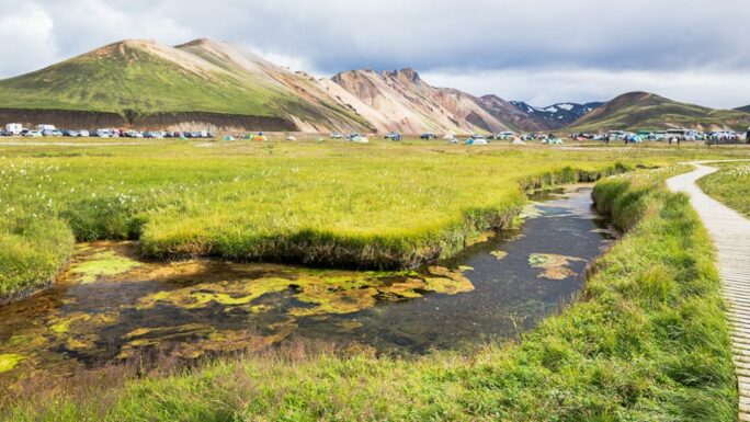
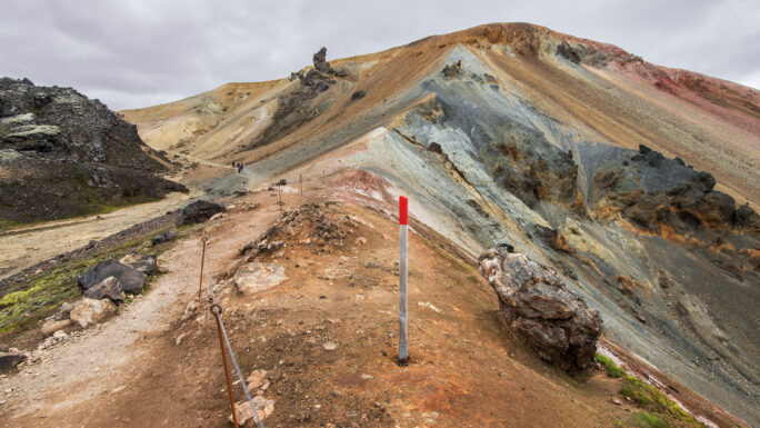
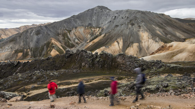
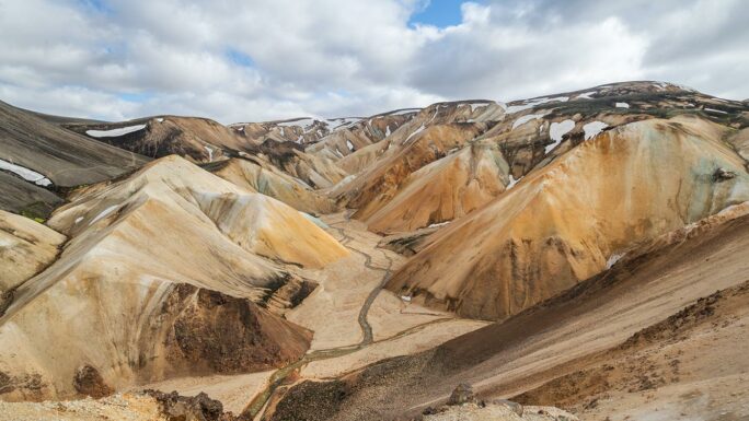
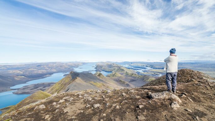
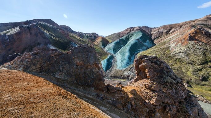
As part of the one-week itinerary, we continue into the Rainbow Mountains. Landmannalaugar – a place like few others. Yes, the campsite is rough and the huts are booked long in advance, but the river water is warm, the air is clean, and everything around is beautiful. You can easily spend several days here – an easy hike around the lava field, a slightly more demanding climb up Brennisteinsalda, a bit harder up Bláhnjúkur, and somewhere in between is viewpoint number 8.
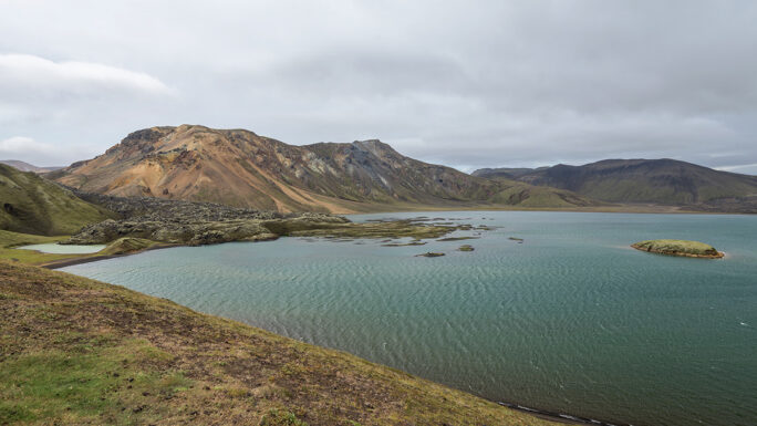
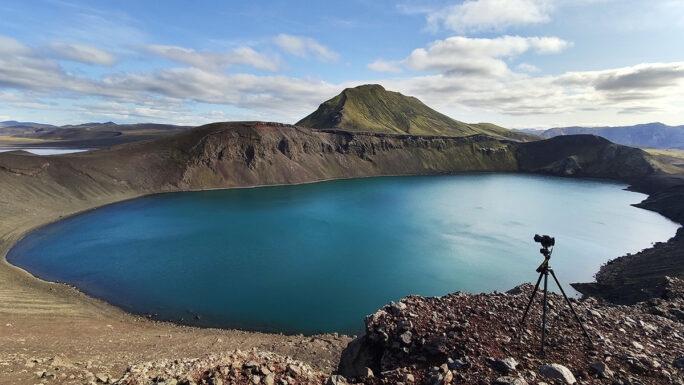
After enjoying Landmannalaugar, we continue along road F208 northwest. A short stop at the famous view over lake Frostastaðavatn is definitely worth it. Further along you can take a short detour to the crater lakes Ljótipollur and Hnausapollur. However, our main stop before leaving the highlands is the charismatic Valley of Tears – Sigöldugljúfur, which is about a 15-minute easy walk from the parking area.
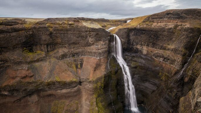
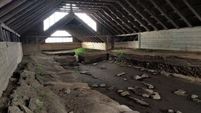
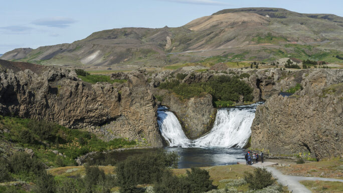
Then we return to civilization, following road 32. On the right side, with a 7-kilometer detour, are the waterfalls Háifoss and Granni. From there we almost return to the main road, but continue along an unpaved track to the fairy-tale valley Gjáin. If you are interested in cultural history, nearby are the remains of the farm Stöng í Þjórsárdal. From there there is no need to turn back – we continue south, and on road 32 just after the bridge we detour to the waterfall Hjálparfoss. Then we head back toward Reykjavík, with a final farewell to the highlands at viewpoint Gaukshöfði. It has been beautiful, it has been demanding, and I believe you will have many memories to take with you. Safe travels!
Accommodation: along the coast hotels + campsites, in the highlands campsites only
Cheap shopping options: Selfoss, Hvolsvöllur, (Vík í Mýrdal, Kirkjubæjarklaustur), ((Höfn))
Total length in km
Total consuming time in days
Difficulty
Availability
Car needed
Main attractions on the route
Meet an experienced guide in Iceland
10 seasons of experience. 99% chance of nice weather and places you didn't know existed.
