A two-wheeler with a four-wheeler feel
The following is not an itinerary in the true sense of the word, but these are places you can reach by 2×2 car that have that Icelandic highland feel.
Oxi pass (road 939/86)
A shortcut along Iceland’s east coast that is quite manageable in a small car. There are Folaldafoss (easily accessible) and Hænubrekkufoss.
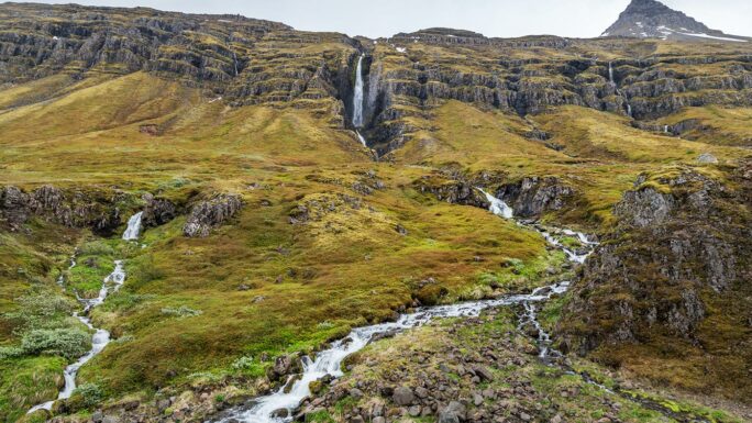
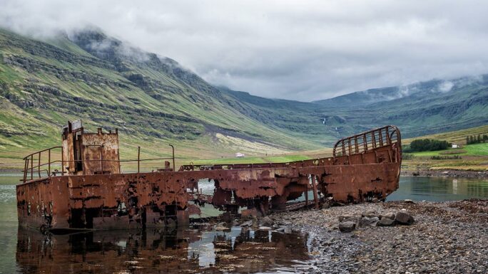
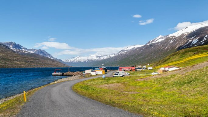
Mjóafjarðarvegur (road 953)
A detour along road 953 on the east coast, where highlights include Klifbrekkufossar, Prestagilsfoss, and a shipwreck in Mjóifjörður. To the village of Brekka (Brekkuþorp) leads a numbered road, and you can continue further east all the way to Dalatangaviti eldri.
Kerlingardalsvegur 214
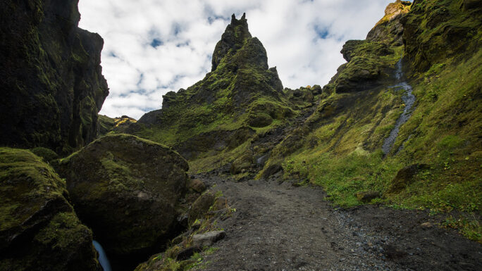
An unpaved road along the south coast near the town of Vík í Mýrdal takes you deep into the true highlands at Þakgil canyon. These 16 kilometres come closer to a genuine Icelandic highland experience than almost anything else accessible without a 4×4.
Gjáin and Þjórsárdalur
I won’t lie — Gjáin is my favourite place in Iceland. To get here in a 2WD car, approach from the south towards Stöng í Þjórsárdal — from there it’s only about 15 minutes on foot to Gjáin.
Hatta
Hatta is a viewpoint you can’t reach by car — you must walk from the church in Vík í Mýrdal. A steep climb awaits you first, followed by untamed highland wilderness.
Þríhyrningur
Þríhyrningur is a mountain near the town of Hvolsvöllur. You can drive to the end of the Vatnsdalur road and set off up this hill — the views from the top already carry the feel of Iceland’s true interior.
Möðrudalur / Fjalladýrð
Möðrudalur / Fjalladýrð is a lovely spot in the north, easily reached about 8 km from the Ring Road along road 901. There’s a farm, a campsite, peace and quiet, goats, dogs, arctic foxes, and occasionally other animals.
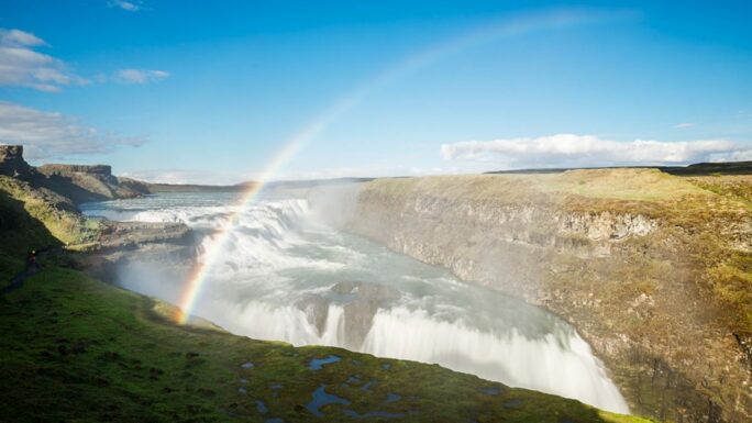
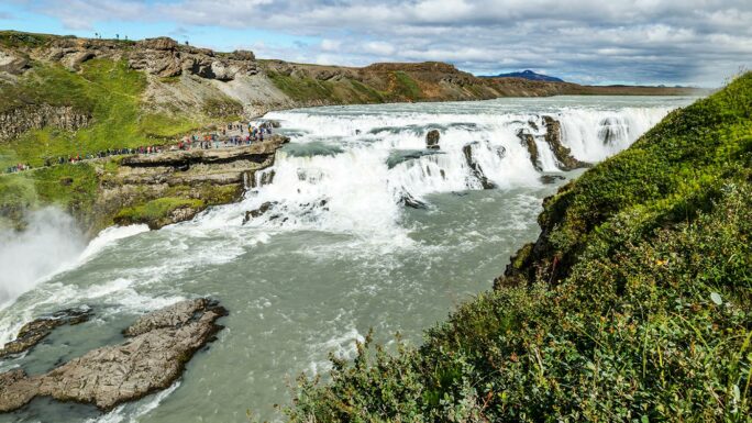
Gullfoss from the other side
99.9% of people head to Gullfoss from the west — there are two huge car parks, a restaurant, and all the facilities. But you can also approach Gullfoss from the east. From road 30, turn north onto road 349 and drive to a small car park. From there, head to the viewpoint of Gullfoss from the eastern bank.
Glymur
The car park at Glymur is easily reached in any car. The hike to the waterfall will feel almost like being in Iceland’s highland interior.
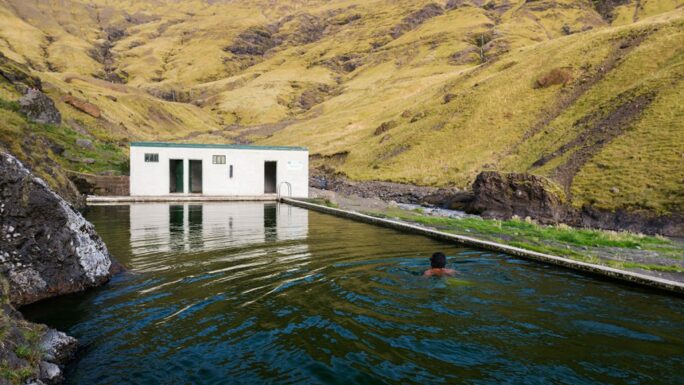
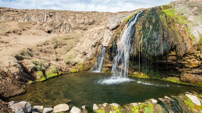
Seljavallalaug
Seljavallalaug — this place nestled between two glaciers has all the character of Iceland’s raw highland interior.
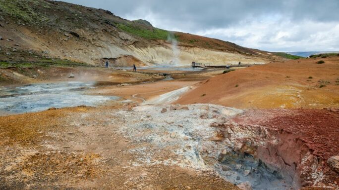
Seltun Krýsuvík
Seltun Krýsuvík — a geothermal area on the Reykjanes Peninsula with bubbling mud pools and sulphurous fumes.
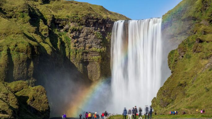
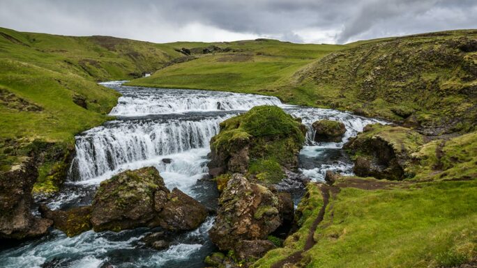
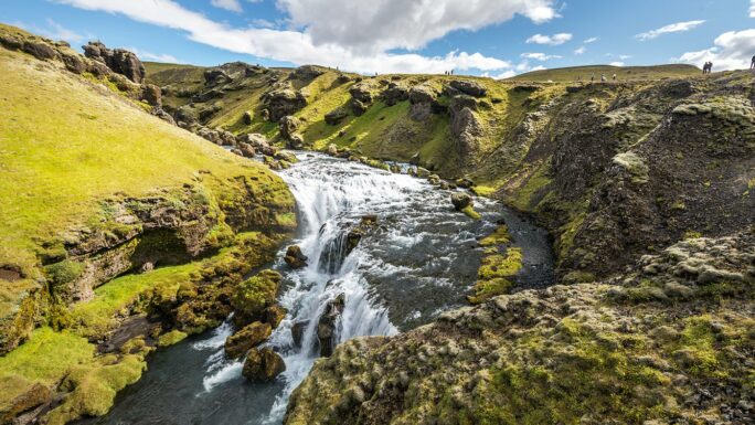
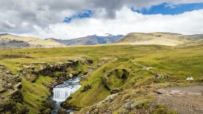
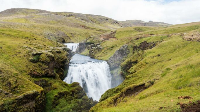
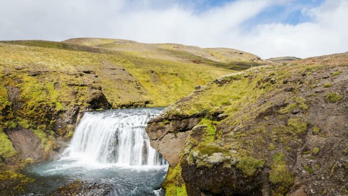
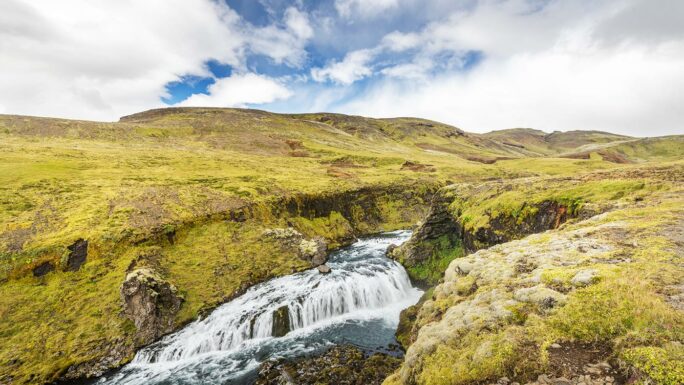
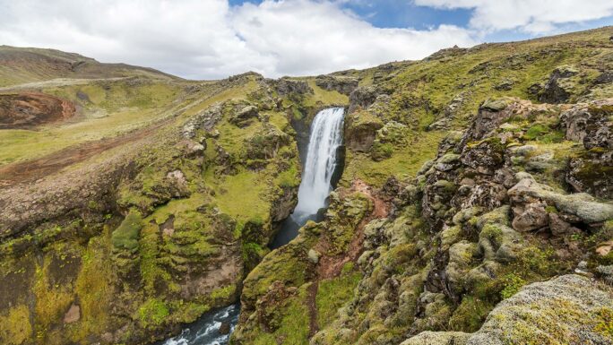
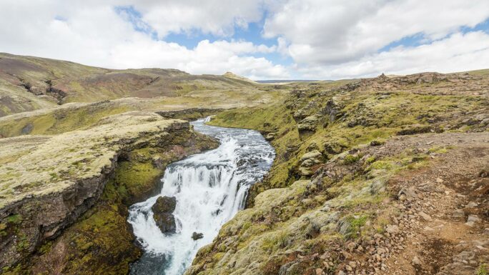
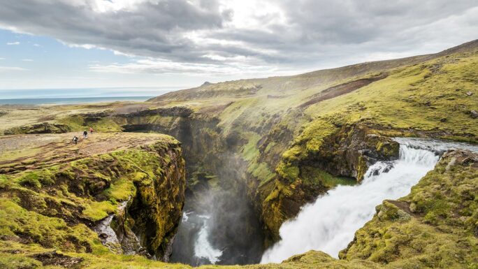
The waterfall trail above Skógafoss
Skógafoss is easily accessible by any car, bike, or scooter. Beyond this waterfall, you can head upstream along the Skógá river. This is officially part of the Fimmvörðuháls trek, and over 8 kilometres you’ll pass dozens of smaller and larger waterfalls. How far you go is entirely up to you. Someone once told me that out of their entire Iceland trip, this hike was the highlight they’ll take home with them. Waterfalls you can see along this route include: Hestavaðsfoss, Fosstorfufoss, Steinbogafoss, Fremri-Fellsfoss, Innri-Fellsfoss, Rollutorfufoss, Skálabrekkufoss, Kæfufoss, Króksfoss, Efstifoss, Slæðufoss.
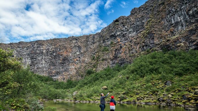
Ásbyrgi
The hike along the eastern rim of Ásbyrgi canyon is a truly off-the-beaten-path experience in every sense.
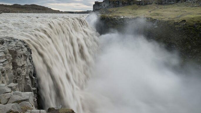
Dettifoss from the east
The eastern car park at Dettifoss is even reached by a paved road. The roughly 800 metres you walk to the waterfall transport you into a completely different world, where raw, intense nature awaits and you can stand literally just a few metres from Europe’s most powerful waterfall.
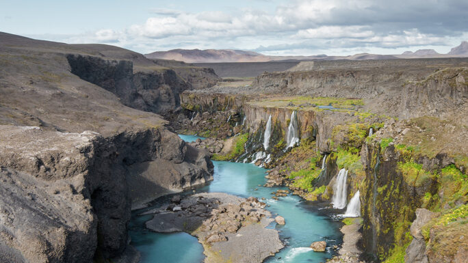
Around roads 887, 888, 889
With the expansion of paved roads in Iceland, these spots on the western bank of the Jökulsá á Fjöllum river are now easily accessible. The main highlights include: Rauðhólar, Hljóðaklettar, Karl og Kerling, Hólmárfossar, Vigabjargsfoss.
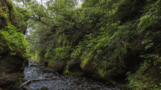
Nauthúsagil
Nauthúsagil — a gorge hidden close to the Ring Road in south Iceland. A mysterious and unexpected place.
Hvannagil & Raftagil
One of the most unjustly overlooked places, literally just a few kilometres from the Ring Road. If you want to feel like Indiana Jones for a moment, Hvannagil might just do it. Right next door is Raftagil.
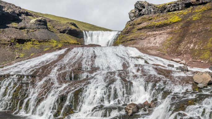
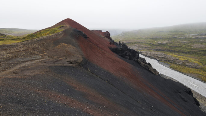
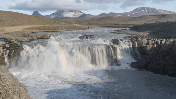
Sigöldufoss and Sigöldugljúfur
Sigöldufoss and Sigöldugljúfur are the first two highlights on the north-western route to the Rainbow Mountains. Sigöldufoss is easy to reach; the road to Sigöldugljúfur gets a bit bumpier. Officially the F208 begins beyond the point you want to reach, but car rental companies may have their own restrictions.
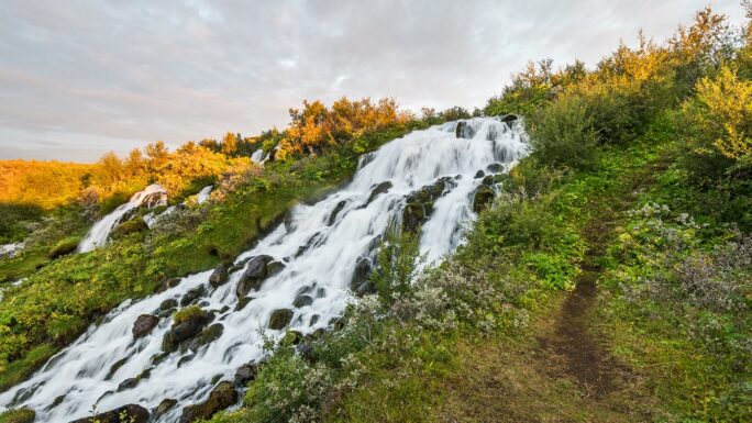
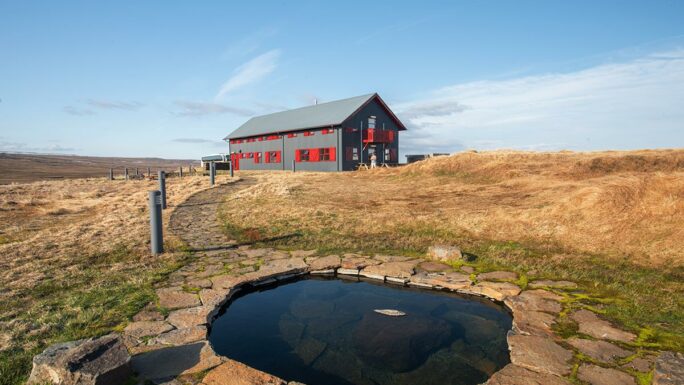
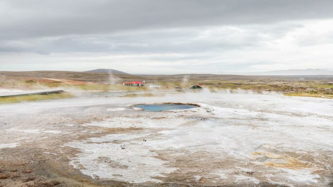
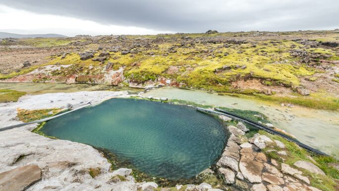
Laugarfell & Slæðufoss
Laugarfell with its geothermal pool and the nearby Slæðufoss — a peaceful spot in the eastern highlands.
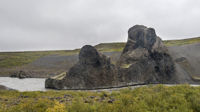
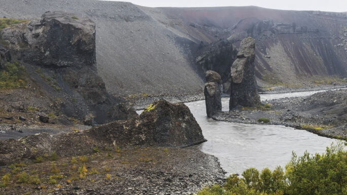
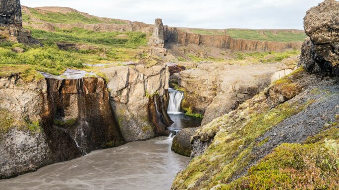
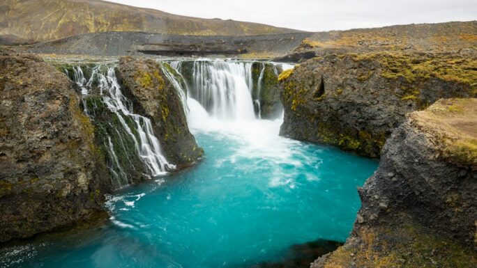
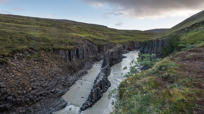
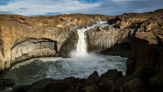
Stuðlagil
Stuðlagil — a canyon with extraordinary basalt columns and a turquoise river. Access from the north side directly to the water’s edge.
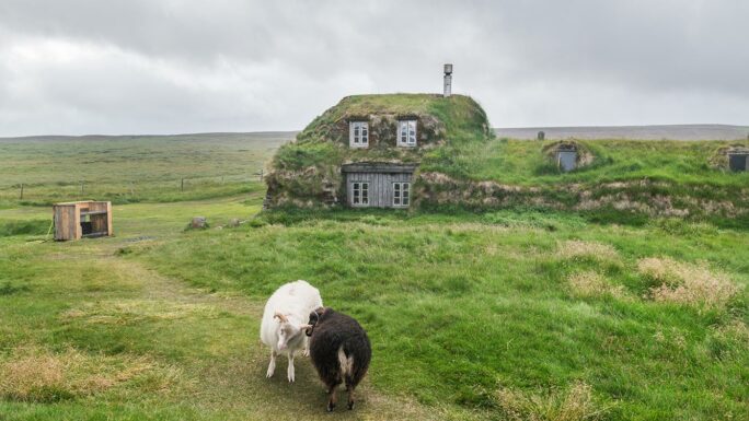
Sænautasel
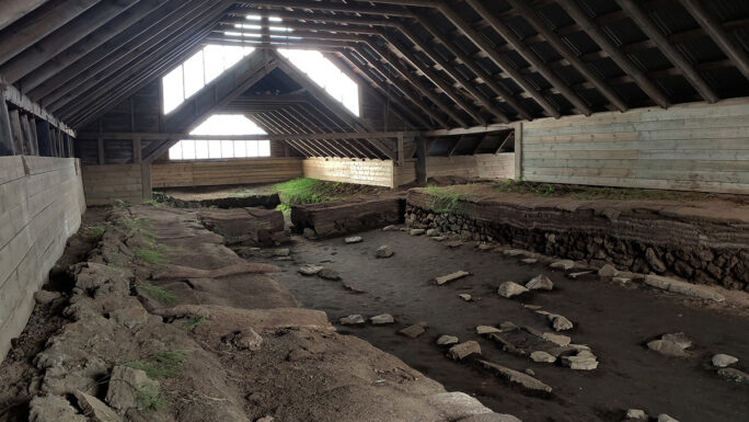
Sænautasel — a reconstructed Icelandic farmstead in the remote interior of east Iceland.
With your own vehicle
This section is not a travel recommendation. Any resemblance to real persons, places, or events is purely coincidental and unintentional. Rental cars have GPS trackers and any violations of restrictions are penalised quite strictly.
Þóristindur / Vatnsfell (F228)
Þóristindur and Vatnsfell lie along the F228 route in the central highlands — accessible during the right time of year.
Laugarvallalaug
Laugarvallalaug — at least as far as the upper junction, then on foot (stream crossing required).
Road 35 (formerly F35)
The F was dropped from road F35 a few years ago. There are no longer any river crossings to negotiate, but rental companies typically do not permit 2WD vehicles on road 35. The Hveravellir area with its geothermal pool Hveravallalaug and the waterfall Gýgjarfoss may be beyond the capabilities of your vehicle.
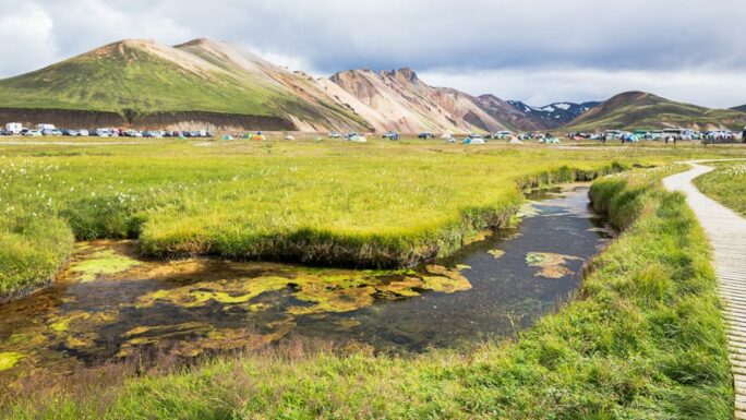
Landmannalaugar via F208 from the north-west
The car park just before Landmannalaugar can be reached from the north-east without having to ford any river — specifically before the ford on F224. No rental 2WD has ever officially made it here, but a few front-wheel-drive cars have been spotted in the car park.
Aldeyjarfoss
Between the start of the F26 from the north and the car park at Aldeyjarfoss there is no river crossing and the road is not particularly difficult. That does not mean this is a travel recommendation.
Main attractions on the route

Meet an experienced guide in Iceland
10 seasons of experience. 99% chance of nice weather and places you didn't know existed.
