Laugavegur
Laugavegur is without a doubt the most famous hiking trail in Iceland, and it stands out globally as well.
It is usually walked from Landmannalaugar to Þórsmörk, and there are good reasons for that. You are not only going from north to south, but also from higher to lower elevation. The Landmannalaugar area sits at around 600 m above sea level, while Þórsmörk is around 200 m. In addition, the first stage in this direction includes a climb up to about 1100 m, so in a sense you are gradually walking downhill with every step. Not by much, but it really adds up.
This also means you are generally looking slightly downward most of the time, which makes the scenery more visually engaging from a hiking perspective.
Another factor is the wind, which usually blows from north to south, meaning you are walking with the wind at your back.
And the lower you go, the warmer it gets. Considering that Iceland’s highlands are cold even in the warmest summer, descending into warmer conditions is also more comfortable.
In short, going from north to south is more user-friendly, comfortable, easier, and more scenic – no wonder most people choose this direction.
Having hiked Laugavegur in both directions, there is one reason why you might consider going south to north.
If you are an adventurous and fit hiker, the south-to-north direction has a unique magic. You start in Þórsmörk, already a beautiful and rugged area beneath the glaciers Eyjafjallajökull and Mýrdalsjökull – something you may have seen before. But as you ascend further, the landscape gradually transforms into something that might make you wonder whether you are still on Earth or on one of the planets from Star Wars.
After all the hardships – walking against the wind, into the cold, and facing a steep 300-meter climb in the penultimate stage – you are rewarded in the final 5 kilometers with a descent into the Duhové hory (Rainbow Mountains), where the landscape hardly resembles Earth as we know it.
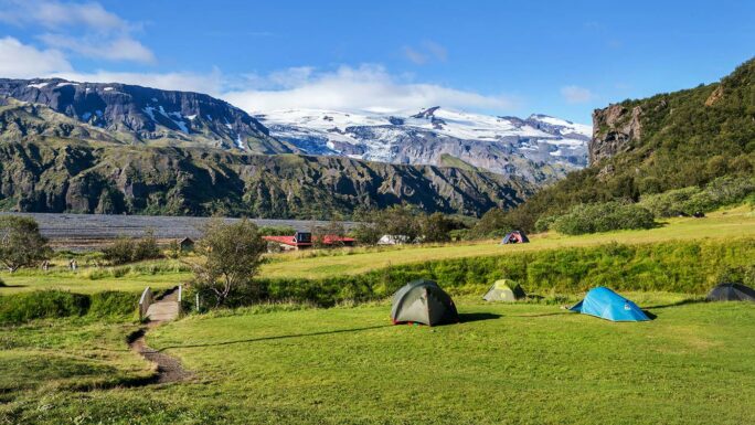
At the end of the journey, you can relax in a geothermal river for as long as you like.
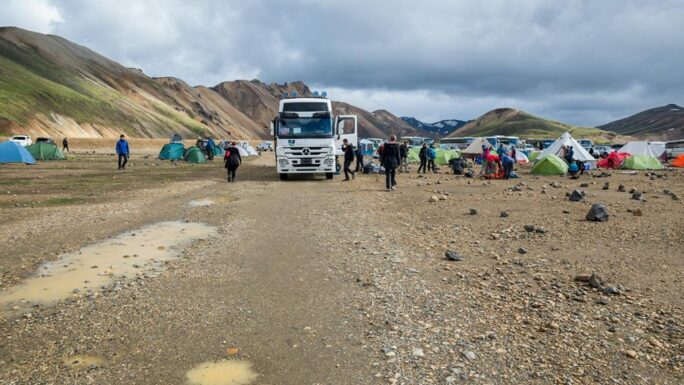
An old saying goes: “Who is prepared is not surprised.” If you plan to use mountain huts along the way, book them ideally six months in advance. Nowadays, even campsites may require reservations, so start planning early.
What should you bring for a four-day trek with unpredictable weather, river crossings, limited chances to dry your gear, and only minimal food supplies along the way? You should already know that yourself.
Let’s go through the route so you know what to expect.
Stages (north to south)
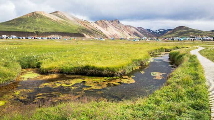
Landmannalaugar – Hrafntinnusker (12 km, +515 m, 0 river crossings)
You pass through the Rainbow Mountains and climb about 500 meters in elevation. There are a few short technical sections, but otherwise the route is relatively easy and requires no river crossings.
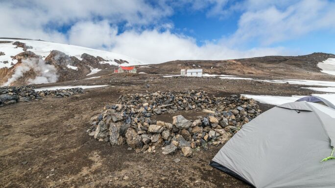
Hrafntinnusker is a harsh campsite where snow often remains until mid-July. It is exposed and offers little protection from the elements. From here onward, the route becomes easier.
Hrafntinnusker – Álftavatn (12 km, −550 m, 2 river crossings)
The first section continues almost flat, followed by the first river crossing where many people take off their shoes. Some manage to hop across without doing so.
Then comes a dramatic descent of 300 meters over just two kilometers, with breathtaking views that are hard to describe in words.
Just below this section is the first major river crossing over Grashagakvísl (knee-deep), usually with a steel cable across the river.
The colorful volcanic terrain disappears, giving way to green landscapes.
After that, it is a few kilometers of easy walking to Álftavatn.
Álftavatn – Hvanngil (4 km, +20 m, 1 river crossing)
A short stage that is often combined with either the previous or the next one. The river crossing is relatively easy (knee-deep).
Hvanngil – Emstrur-Botnar (12 km, −100 m, 1 river crossing)
Arguably the least exciting stage of the entire trek – you have already seen most of what there is. The terrain is mostly flat with a steeper descent at the end. A long section runs parallel to road F261. The river crossing is above knee level but fairly straightforward, and another river is crossed via a pedestrian bridge.
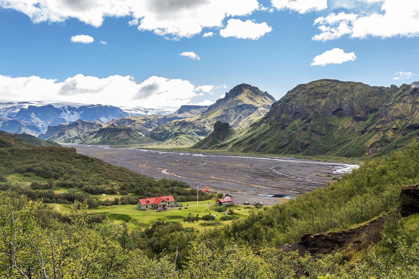
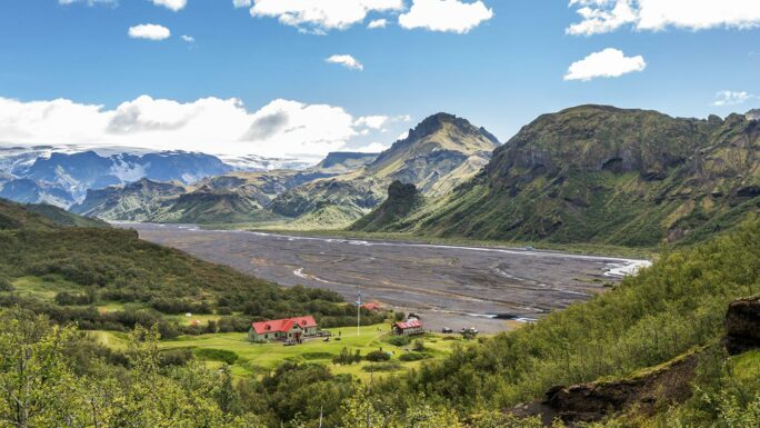
Emstrur-Botnar – Þórsmörk (15 km, −200 m, 1 river crossing)
This is a rewarding stage with many bends and surprises. You often leave the main path to explore viewpoints just a short distance away. Even after many Icelandic landscapes, the canyon of the Fremri-Emstruá river (crossed via a bridge) feels almost otherworldly.
The final river crossing is knee-deep, but the river feels powerful and demands respect.
From there, you walk through birch vegetation into Þórsmörk, and the journey is yours to finish.
Wishing you many happy kilometers on the trail.
Meet an experienced guide in Iceland
10 seasons of experience. 99% chance of nice weather and places you didn't know existed.
